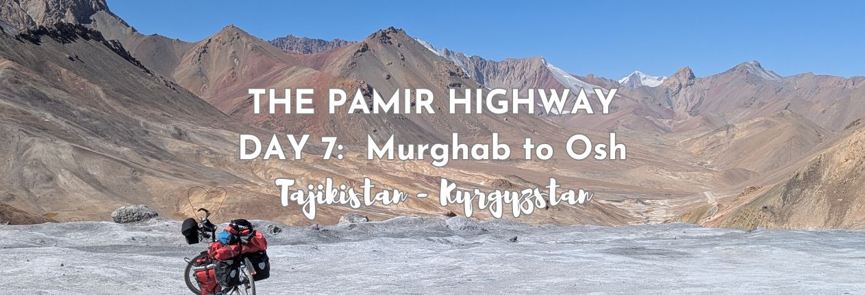
Murghab sits high on the Pamir plateau, it’s at 3,618 meters (11870 feet), we’re not supposed to be here, we’re supposed to have overnighted at Karakol Lake, but yesterday we had a medical emergency. One of our team members is sick and under the doctor’s orders not to leave Murghab until he says so. Today, our first stop is the hospital in Murghab, and then we’ll find out if we can indeed finish our Pamir Highway trip. This is Day 7 of our 7-day Pamir Highway journey from Dushanbe to Osh, and today we hope to cross the highest point of the entire route before leaving Tajikistan behind and descending into Kyrgyzstan.
THIS POST MAY CONTAIN COMPENSATED AND AFFILIATE LINKS MORE INFORMATION IN OUR DISCLAIMER
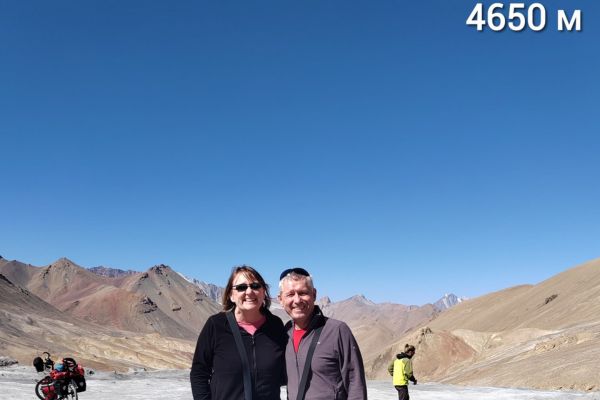
The journey today includes Ak-Baital Pass, the highest point on the Pamir Highway at 4,655 meters (15,272 feet), before crossing the Tajik–Kyrgyz border at Kyzyl-Art Pass. And then we’ll coast down to a delightful Osh at less than 1,000 meters (3280 feet) in altitude.
If you want the full route overview first, you can read my 7-day Pamir Highway itinerary here.
PRACTICAL TRAVEL TIPS
- 🛡️ Get Travel Insurance: Civitatis includes medical expenses, repatriation, theft, luggage delays. No deductibles or upfront payments. Get a quote here.
- 💰 Read about cash, ATMS and paying for things in Tajikistan
- 🔌 Check out the Tajik plug, socket & power situation. Buy this adapter.
- 📶 Get online EASILY & cheaply – One eSim for the world. Data never expires
Quick Overview of the Route and Statistics
Start: Murghab
End: Osh (Kyrgyzstan)
- Distance: Approximately 280 kilometers (174 miles)
- Driving time: 7–8 hours, including stops and border crossing
- Starting altitude: 3,618 meters (11,975 feet)
- Highest altitude today: 4,655 meters (15,272 feet) at Ak-Baital Pass
- Border crossing altitude: 4,280 meters (14,042 feet) at Kyzyl-Art Pass
- Final altitude: 963 meters (3,159 feet) in Osh
If you’re catching up, then don’t miss what happened yesterday on Day 6 of our Pamir Highway trip.
Day 7 – Pamir Highway, What Happened
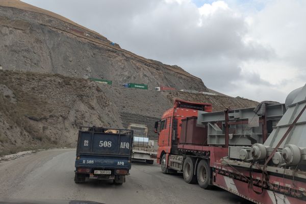
Our start this morning is, as usual, 07:30 breakfast, and an 08:00 start, but the start is different. We have to be at the hospital by 08:00, that’s when it opens. As I finished with yesterday’s update, Robert is walking in a straight line, and much to our collective dismay, decides that he’s paying for the rest of our accommodation costs as he feels he’s been an inconvenience. Of course, he hasn’t, but we’re all glad that this happened here, where medical help was available.
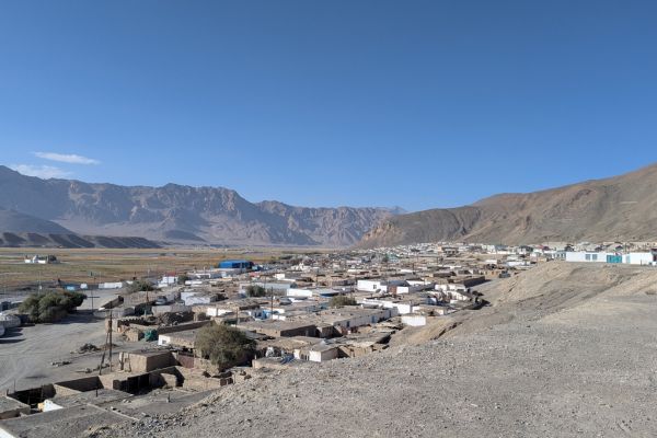
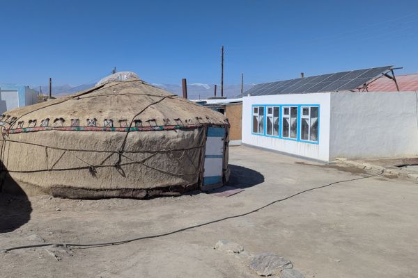
First stop, the hospital at Mughab
This hospital received funding from USAID. Lucky says Robert, the funding was already here before the agency was dismantled. His vitals are taken again, and his blood pressure is now normal. His blood oxygen levels are now at 94%. The doctor declares that he can go, but only if he makes “very quick stops” and gets down to Osh at 800 or so meters as soon as possible. He speaks with Habib and says 1 or 2 minutes at the high pass, no more.
We’d asked yesterday how we paid for the healthcare, “tomorrow, tomorrow”, the doctor said. Don’t worry said Habib, it will be perhaps 100 or 150 somoni (US$10-15). And so today, when Robert asks how much, he’s told, “You don’t have to pay”. It seems incredible. That here in this small town, hours and hours from any other medical support, this life-saving healthcare is free for visitors. Robert asks again what he should pay, and the amount is the same. He leaves 200 somoni.
He’s received half a litre of fluids, multiple checks, one anti-nausea injection, and one antibiotic injection. We’ve made notes of all of it for his records. It’s an incredible service they provide here. You can read more about the Doctor and his work here
So we can leave, but Robert can’t eat properly until he gets to Osh, and so he clutches the biscuits, swigs the electrolyte replacement fluids, and has now at least retained some colour.
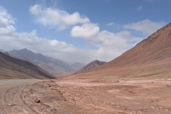
The Ak-Baital Pass
We also stop at the Ak-Baital Pass at 4655 meters. Time for photos before we head off. There are cyclists here who’ve come from the Kyrgyzstan side of the border. It’s a brutal climb. Even Habib’s Land Cruiser found it hard coming up. We consider whether electric vehicles would have a better time of it, but somehow never seem to find the internet connection to check. It turns out that electric vehicles can work better at altitude than internal combustion engine vehicles – they’re not losing the 20-30% of power associated with low air density. Cold temperatures, however, can have an effect on battery life.
You can read more about altitude on the Pamir Highway here.
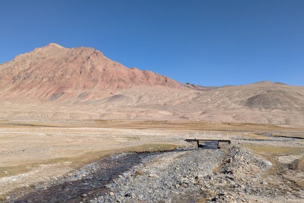
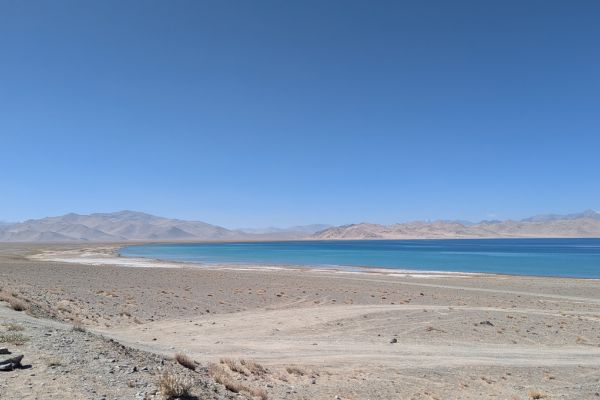
Karakol Lake
We have two brief stops. One at Karakol Lake, where we were supposed to stay last night.
I truly admire the people who live here year-round (and I have to commend them on their toilet in the homestay that we were supposed to be at), but I couldn’t live here.
It’s vast and empty.
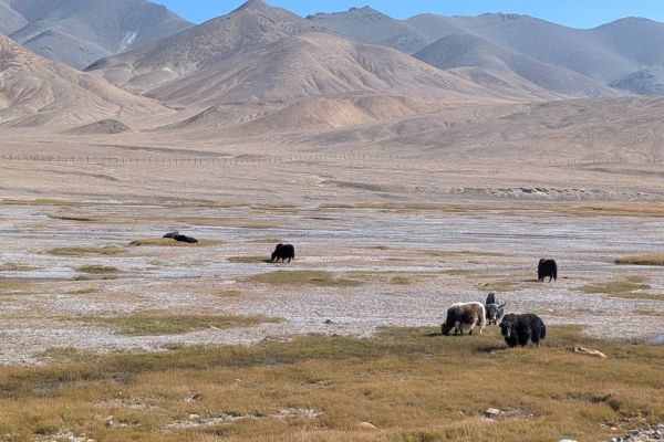
But we see Yaks on the way.
Crossing the Border from Tajikistan to Kyrgyzstan
And from then on it’s downhill. Until we get to the border. It seems it’s lunchtime. And there’s a slight delay, it seems, because a few cars are coming in the other direction. Paul, the French motorcyclist whom we’d met in Khorog, arrives and manages to talk his way through ahead of us. Habib then plays the sick passenger card – “ we have to get him down to Osh asap”. And it works. We get through quickly.
There’s about a 25 km drive through no man’s land to go through before we get to the Kyrgyzstan border control. We’ve caught Paul up again; he’s going through paperwork for his bike. We all get through passport control, and then there’s a problem.
Problems at the Border – our driver can’t continue
Habib’s Land Cruiser is ok, but they won’t let him drive it. They don’t like his license. And they take it off him, providing him with a slip of paper.
Don’t worry, he says, he will arrange a car. We’re miles from the nearest town, but it happens that there’s a car and a driver there from Sarytash, the nearest town, and he’ll take us to Osh and the end of the trip.
And all of a sudden, it happens quite quickly, our new driver is here. And we’re saying goodbye to Habib. Who now, instead of taking a 12-hour trip from Osh to Dushanbe, has to return to Tajikistan and take nearly 24 hours to return to Dushanbe for his next clients. This is a brutal way to earn a living.
Our new Kyrgyz driver takes us to Osh.
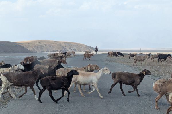
Our new driver has a Lexus. The roads are measurably better than those in Tajikistan. The drivers, well. That remains to be seen. The landscapes have changed. It’s less spiky high barren mountains, more green steppe, red rocks.
We get to Sarytash, where Vladimir decides to leave us. He’s planning on hiking around this area, and there’s a guesthouse he wants to stay in, which has a view of Lenin Peak (the highest mountain around here) from the shower. We leave him at a guesthouse where Paul’s bike is in the parking lot, so we imagine they’ll catch up.
Sarytash to Osh – road closed!
Our adventures aren’t over yet. There’s a road closure on the way to Osh. Miles and miles of backed-up trucks. The rules of the road change. If you can see the road you drive on it. We pass on the left, the right. We drive down the middle of the road. At one point on a single-track road, there are four lanes going in one direction.
I get the front seat, and Robert is seatbelted in the back. And so our driver and I chat using Google Translate. He’s 59. He has a full grill of gold front teeth. I want to ask for a photo, but it seems rude, so I don’t. He gets his daughter-in-law on the phone, and we chat, and then WhatsApp. She’s in Bishkek, but can speak and write English, so we work out a route to our hotel and Robert’s guesthouse in Osh.
Arriving in Osh
And then all of a sudden we’re done. We arrive in Osh, hug Robert, and he has our number. If there are problems (but we bump into him, walking through a park in Osh a day or so later, so we know he’s good). Our hotel has a private bathroom, a comfortable bed, WiFi, and is in close proximity to a place that serves coldish beer and smoked checil cheese beer snacks.
It has definitely been an adventure. And we’re only just over a week into our Central Asia trip, there are 5 more weeks to go! We traveled with DiscoverthePamirs – on this trip – I’d recommend the company, the driver, and the route.
Pamir Highway Day 7: Road Conditions & Driving Reality
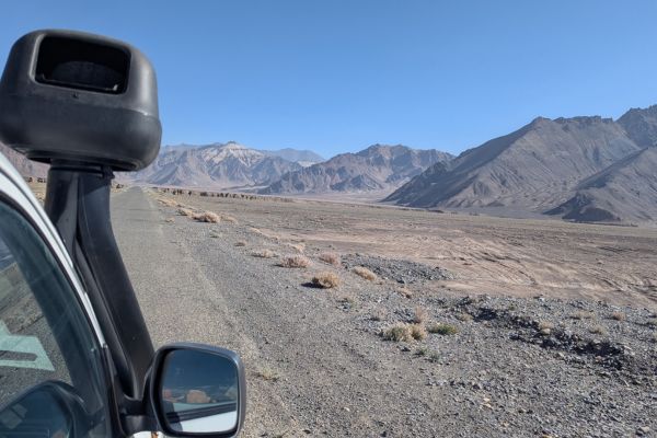
The road leaving Murghab is relatively straightforward — wide, open plateau driving with occasional rough sections. As you approach the Ak-Baital Pass, the road climbs gradually rather than dramatically. The altitude is the real challenge here, and even Habib’s mighty Land Cruiser struggles.
The Tajik side of the road remains rough in places, but once across the Kyrgyz border, the road quality improves noticeably.
Pamir Highway Day 7: Key Stops Along the Way
Our stops are logistical more than anything on this last day of our Pamir Highway trip.
Karakol Lake
Our schedule had us staying here overnight, but now, it’s just a toilet stop for us, although Vladimir does go for a wander – to find the lake this time, not beer. The best views of the lake, though, are en route rather than in the town itself.
The Ak-Baital Pass
At 4,655 meters (15,272 feet), Ak-Baital Pass is the highest point of the entire Pamir Highway. The pass itself is stark and windswept, with wide views across the surrounding mountains. It really is beautiful in a “this is killing you slowly” sort of a way.
Kyzyl-Art Pass (Tajik–Kyrgyz Border)
The border crossing sits at 4,280 meters (14,042 feet). You’ll go through the Tajik exit formalities first, getting your passport checked, and then handing over your GBAO pass.
Then it’s a drive through a neutral zone before reaching the Kyrgyz checkpoint. Even in this neutral area, the landscape changes. There’s more red in the rocks, and it’s somehow softer.
TAJIKISTAN TRAVEL RESOURCES
AIRPORT TRANSFERS
24/7 pickup & drop off. Trusted, local English speaking drivers. Prebook & prepay online with cards.
Book a Transfer
HOTELS AND APARTMENTS
See choices here
Double rooms?Budget rooms? Need a washing machine? The best choice of hotels & apartments.
TOURS & ATTRACTIONS
Most excursion choices, small group tours, skip-line tickets, free cancellation and top local guides.
Top options here.
PAMIR HIGHWAY
Choose routes here
Best choice of vehicles, dates, drives and routes. Book early for more options.
Final Thoughts on Day 7 of the Pamir Highway
This is the last day of our Pamir Highway journey. It feels like it’s come way too quickly. We left the safety of Murghab and the hospital there, rose to Karakol Lake and then crossed the highest point of the route, left Tajikistan (and Habib) behind, and descended from the stark high plateau into the redder and greener valleys of Kyrgyzstan. It’s been a glorious trip. And I have loved every moment of it.
ASocialNomad is a participant in the Amazon Services LLC Associates Program, an affiliate advertising program designed to provide a means for sites to earn advertising fees by advertising and linking to amazon.com, amazon.co.uk, and amazon.ca. Amazon and the Amazon logo are trademarks of Amazon.com, Inc. or its affiliates. As an Amazon Associate, I earn from qualifying purchases.