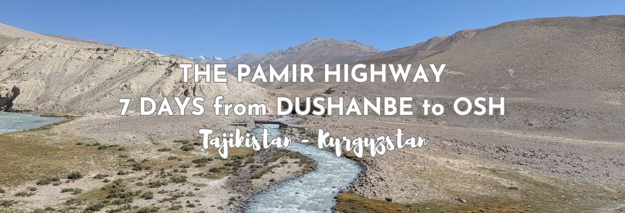
There are road trips, and then there is the Pamir Highway. This isn’t a smooth scenic drive with cafés every few kilometers and a reliable mobile signal. It’s rough in places. It’s high — very high. It’s remote. And for long stretches, it feels like you’ve driven to the edge of the world and just kept going. Traveling the Pamir Highway from Dushanbe to Osh is one of the most unforgettable journeys I’ve ever taken — not because it was easy, but because it wasn’t. The landscapes are vast and empty. The villages are small and resilient. The air gets thinner every day. And somewhere between the Wakhan Valley and the high plateau near Murghab, you’ll never want it to end. This is my guide to traveling the Pamir Highway.
THIS POST MAY CONTAIN COMPENSATED AND AFFILIATE LINKS MORE INFORMATION IN OUR DISCLAIMER
The Pamir Highway (the M41) connects Tajikistan and Kyrgyzstan across some of the highest roads in Central Asia. It follows ancient Silk Road corridors, Soviet military routes, and valleys that run alongside Afghanistan. In places, you’re driving with the Panj River on one side and Afghan villages clearly visible across the water on the other.
It’s dramatic. It’s beautiful. And it demands a whole lot of attention and respect.
You’ll see itineraries online that promise to “do” the Pamir Highway in three or four days. Technically, yes — you can drive it that fast. But you won’t experience it. You won’t acclimatize properly. You won’t hike to Jizeu. You won’t linger in the Wakhan Valley. You’ll rush through Bulunkul and Murghab without understanding how high you really are.
For me, seven days is the minimum that makes sense. That gives you time to adjust to the altitude gradually, explore side valleys, spend a night in a remote village, and let the landscape change around you instead of blurring past your window.
In this guide, I’ll walk you through exactly how to travel the Pamir Highway from Dushanbe to Osh in seven days — what to expect, how to prepare, the best direction to travel, permit requirements, altitude realities, and how to break the journey into manageable stages. I don’t have fancy photos, Instagram, or glossy reels. What I do have is a realistic guide to one of the most remarkable road journeys in the world, what it’s like to experience it, and how you can too.
PRACTICAL TRAVEL TIPS
- 🛡️ Get Travel Insurance: Civitatis includes medical expenses, repatriation, theft, luggage delays. No deductibles or upfront payments. Get a quote here.
- 💰 Read about cash, ATMS and paying for things in Tajikistan
- 🔌 Check out the Tajik plug, socket & power situation. Buy this adapter.
- 📶 Get online EASILY & cheaply – One eSim for the world. Data never expires
What is the Pamir Highway?
The Pamir Highway is the name most travelers use for the M41 — a high-altitude road that cuts across eastern Tajikistan and southern Kyrgyzstan, linking the capitals of Dushanbe and Osh. On a map, it looks like a single line running through the mountains. On the ground, it feels like a lifeline through one of the most remote regions in Central Asia.
Parts of this route follow ancient Silk Road corridors that once connected China to the Middle East and Europe. For centuries, traders, explorers, and armies crossed these valleys. The modern roads, however, largely date back to the late nineteenth and early twentieth centuries, when the Russian Empire — and later the Soviet Union — built and reinforced sections of it for military and strategic reasons.
The result is a road that climbs above 4,000 meters, threads through narrow river gorges, skirts the Afghan border for days at a time, and crosses windswept plateaus where the horizon seems endless. And in a lot of places, no, it’s not really even a road. It’s more of a promise of a road.
It’s often described as one of the highest international highways in the world. The highest point on the main route, Ak-Baital Pass, sits at 4,655 meters above sea level. Even the towns along the way are high. Murghab, for example, sits at roughly 3,600 meters — higher than a lot of Alpine ski resorts.
However, the Pamir Highway isn’t a single consistent road surface. Some stretches are smoothish tarmac. Others are broken, potholed, or completely unpaved. Landslides, river damage, and weather can all change conditions from one season to the next.
Geographically, the route begins in Dushanbe in western Tajikistan. It climbs east into the Pamir Mountains, follows the Panj River along the Afghan border through the Wakhan Valley, crosses a high-altitude desert plateau near Bulunkul and Murghab, and eventually exits Tajikistan at the Kyzyl-Art Pass before descending into Kyrgyzstan and finishing in Osh.
It is an incredible journey from Tajikistan’s busy capital city of Dushanbe, through gloriously green farmland, to surreal glacier melt blue rivers flowing through stark lunar landscapes. It is glorious.
And that’s exactly why it’s worth doing properly.
Why Travel the Pamir Highway?
There are easier road trips. Way, way easier ones. And I speak from experience. We’ve gone from the UK to Bansko, Bulgaria, several times, we’ve “done” Route 66, we’ve driven from Vancouver to Calgary (and back), Los Angeles to Minneapolis, and then Chicago. We’ve overlanded from Istanbul to Uzbekistan. Then there was a 6-week “jaunt” from Stockholm to Helsinki, to Tromso to Oslo.
So I can say with experience that when it comes to road trips, there are more comfortable ones. There are routes with WAY better infrastructure, smoother roads, reliable (ish) Wi-Fi, and predictable services.
The Pamir Highway is not that, but that’s exactly the point.
We traveled the Pamir Highway for the scale of it. And the sheer experience of it. The mountains here are not gentle or decorative — they’re massive, sharp, and close and yet far away at the same time. In the Wakhan Valley, you drive with Afghanistan visible across the river, close enough to see people working in the fields on the opposite bank, near enough to hear gunfire occasionally. It’s surreal, and you consider whether it’s a dream or actually happening to you.
There are miles and miles with no fuel stations. No shops. Just the road, the river, and the mountains. In a connected world, it is gloriously unconnected.
Traveling the Pamir changes you. There’s a peace and a timelessness here that now, months later, remains in me. The journey here IS the experience.
Why 7 Days should be Your Minimum to travel the Pamir
You’ll see a bunch of itineraries that squeeze the Pamir Highway into three or four days. And to be fair, if that’s all you’ve got, go for it. It’s better to come than not at all. Because technically, it’s possible. If you leave early, drive long hours, and skip most side valleys, you can get from Dushanbe to Osh quickly. Ha, and even as I’m writing this, I can see a “Two Day Pamir Highway Experience” – well, it’s a bit of it certainly. Here are some “short Pamir experiences.
But shorter trips aren’t really traveling the Pamir Highway. They’re just surviving it. (and the two-day option, I’d call it more of a 2-day trip to Kalai Khumb.
The biggest reason seven days is the minimum you should take to travel the Pamir highway is the altitude. You don’t go from low elevation to sleeping at over 3,500 meters comfortably in a single leap. Your body needs time to adjust. Want more on altitude? Here’s my day-by-day experience of hiking to Everest Base Camp, where, on Day 7, we had the fittest member of our team airlifted back to Kathmandu because of altitude sickness.
By taking the road gradually, climbing from Dushanbe (706 meters) through Kalai Khumb (1200 meters), into the Wakhan Valley (2,500 to 3,000 meters), and then onto the high plateau, you give yourself a realistic chance to acclimatize. Do this quickly, and the uncomfortable and dangerous altitude sickness becomes much more likely.
Seven days also allows for some delightful detours that make the journey much more of an experience than an endurance. Detours, like, for instance, hiking to Jizeu, which isn’t something you squeeze into a rushed schedule. It takes time. Jizeu village isn’t accessible by road at all, and spending a night there adds depth to the experience. Without that, you’re just passing through the Bartang region without truly experiencing it.
The same applies to the Wakhan Valley. Yeah, you might get some great photos with short stops, but driving through without stopping at places like Bibi Fatima misses what makes this part of the country so special.
Then there’s the Bulunkul region and the high plateau before Murghab. These are stark, wind-swept, high-altitude landscapes where, on a map, it looks short, but the journey feels endless. In an enjoyable way.
Finally, there’s the border into Kyrgyzstan at Kyzyl-Art Pass. Crossings don’t always run like clockwork (spoiler – ours didn’t), but the landscape changes almost immediately you cross the border. And yes its glorious, just in a different way.
So, traveling the Pamir in seven days. Not necessary, you CAN do it faster, but you shouldn’t. And if you have more than seven days, even better — there’s always more to see in the Pamirs.
Dushanbe to Osh vs Osh to Dushanbe
The Pamir Highway can be traveled in either direction, and there are a heap of different options to select from. Most travelers of the Pamir choose their direction based on logistics — flights, visas, or where they happen to be starting in Central Asia.
But if you have the choice, I firmly believe that direction matters, and I strongly recommend traveling from Dushanbe to Osh.
Why Dushanbe to Osh Works Better
The biggest advantage of traveling the Pamir from Dushanbe to Osh is altitude progression.
Dushanbe sits at roughly 700 meters above sea level. From there, you climb gradually — first into river valleys, then into the Wakhan region, and finally onto the high plateau near Murghab and Ak-Baital Pass. Your body adjusts day by day rather than being thrown into extreme elevation immediately.
By the time you reach Bulunkul and Murghab — where you’re sleeping above 3,600 meters — you’ve already had several days to acclimatize.
I like the flow too. You start in Tajikistan’s busy capital city, and your progression feels like stepping back in time. The scenery becomes more dramatic. The villages become smaller. The road becomes rougher. The air gets thinner. The landscape opens into a vast plateau. Then, finally, you cross into Kyrgyzstan and descend into Osh, which, true, might be the second city of Kyrgyzstan, but it really, truly feels like a friendly town atmosphere.
What About Osh to Dushanbe?
This is the logical decision-making process we applied to it. And we took our experiences with altitude in Nepal, Peru, and Colombia into account.
If you travel the Pamir from Osh to Dushanbe, you hit altitude almost immediately.
Within a short time of leaving Osh, you’re climbing toward high passes above 3,600 meters. If you haven’t acclimatized elsewhere, that’s a big jump. It can be better logistically, but it’s harder on you and your body. Your last day driving into Dushanbe will be something of an anticlimax too – you’ll head into the long, stretched out sprawl of the Tajikistan capital and the noise and dust that comes with it.
My Recommendation for the direction on the Pamir Highway?
If you can choose, go from west to east, aka Dushanbe to Osh. It’s a safer progression for altitude.
My 7-Day Pamir Highway Route (Overview)
This is the route I recommend; it’s not rushed and gives you some great side trips and experiences along the way. Truly, sometimes you’ll feel as though you’re almost twiddling your thumbs (and believe me, when you’ve traveled for some time, that’s rather nice!)
Day 1: Dushanbe to Kalai Khumb
You leave the capital and begin climbing into the mountains. The road narrows, the traffic lessens, and the Panj River appears. Afghanistan is suddenly visible across the water. It’s a very surreal moment for me, it really, truly does not feel real, after all we’ve read over the years since we were supposed to be here in 2017, but when life intervened.
My full guide on traveling from Dushanbe to Kalai Khumb is here.
Day 2: Kalai Khumb to Jizeu Village
This is where you step off the Pamir proper into the Bartang Valley; it’s one of the most remote and desolate areas of the Pamir. This was my favourite experience of the Pamir. Hiking up about 400 meters in altitude to Jizeu Village and spending the night there at 2,500 meters in a homestay.
My full guide on traveling from Kalai Khumb to Jizeu is here.
Day 3: Jizeu to Khorog
Today, we hike back down to the river crossing and drive to Khorog, the largest town in the Pamirs. You’re very firmly in the GBAO region here, and there are multiple checkpoints for all our visas and permits. Khorog is the administrative center of the GBAO region. It’s a delight, with Botanical Gardens, a stunning river running through it, and some superb homestay options.
My full guide on traveling from Jizeu to Khorog is here.
Day 4: Khorog to Bibi Fatima
This part of the trip, the Wakhan Valley, is one of the most striking sections of the Pamir Highway. There’s a lot of driving alongside the river, with Afghanistan on the other side. There are ancient fortresses like Yamchun, and the surprisingly lovely hot springs of Bibi Fatima.
My full guide on traveling from Khorog to Bibi Fatima is here.
Day 5: Bibi Fatima Hot Springs to Bulunkul Lake
We leave the tree line completely today and climb away from the river valleys into the high plateau. The landscapes and vistas are wide, stark, and wind-swept. Bulunkul Lake and nearby Yashilkul Lake sit at a serious altitude, 3,700 meters. The air is thinner. When the sun goes its chilly to say the least.
My full guide on traveling from Bibi Fatima to Bulunkul Lake is here.
Day 6: Bulunkul Lake to Murghab
Bouncing back onto the M41, the Pamir Highway today, we’ll stay on the plateau and head to Murghab, one of the highest towns in Central Asia. There’s a stop at the snow leopard “sanctuary”, and there are endless horizons, enormous skies, and on arrival in Murghab, the seriously life-threatening reality of living at 3,500 meters above sea level.
Our original itinerary was to be Bulunkul Lake to Karakul Lake, but a medical emergency with one of our fellow travelers meant that we stayed the night in Murghab instead.
My full guide on traveling from Bulunkul Lake to Murghab is here.
Day 7: Murghab to Osh, Kyrgyzstan
Our original itinerary for this day was to be starting this day from Karakul Lake, some 4 hours on from Murghab, over the 4665 meter AK Baital Pass. Our plan was lunch on day 6 in Murghab, but lunch led to our medical emergency. And so our final day was a long push from Murghab to Osh. And drama wasn’t done then. We had a crisis at the border, too.
There’s a high pass, the Kyzyl-Art border, and a descent into Kyrgyzstan. After days in extreme altitude and isolation, arriving in Osh feels almost surreal.
My full guide on traveling from Murghab to Osh is here.
How to Travel the Pamir Highway
There isn’t a public bus that neatly runs from Dushanbe to Osh with scheduled scenic stops along the way. There are shared rides – marshrutkas that run between certain points. Mainly on the Tajikistan side from Dushanbe to Kalai Khumb, but you’ll need plenty of time, patience, and an acceptance of a lower level of comfort to use these. You’ll need to plan very carefully how you’re going to do it.
Any way you choose to travel the Pamir Highway takes planning. It also takes flexibility. Most people choose one of five options, depending on budget, confidence, and how much control they want over the pace of the journey.
Traveling the Pamir Highway in a Shared 4WD (Most Common Option)
This is how most independent travelers do it. This is how we did it.
You join a small group — usually four to six people — in a 4WD vehicle with a local driver who knows the road, the checkpoints, and the seasonal conditions.
Pros of Traveling the Pamir Highway in a Shared 4WD:
- The cost of the transport, driver (and optional guide) is shared between passengers
- You pay for your own rooms in homestays along the way
- You pay for your own food along the way
- The driver handles navigation and road conditions; his local knowledge is key
- It has a relatively flexible stop schedule
Cons of Traveling the Pamir Highway in a Shared 4WD :
- Much of your experience depends on the group you’re with. Bad travel mates = bad experience, great travel mates = great travel experience. (We had the latter and it was a FABULOUS trip)
- Much of your experience depends on the driver. Ours, Habib, was amazing, and I’d recommend him to anyone and everyone.
- The pace of your journey depends on the group
- Departure dates can require waiting until a group is ready to go.
- Cost varies depending on fuel prices and group size, but it’s typically the most practical middle-ground option. Most of the 4WD vehicles seat the driver plus four people; if there are only 2 or 3 who sign up, then you *might* end up paying for the empty seats.
- Four people to a car means someone always gets the middle back seat (great for views, not so good for comfort, although to be fair, the middle seat of a Toyota Land Cruiser is actually pretty damned good!
For most travelers, this way of traveling across the Pamir highway is the best balance of safety, flexibility, and cost.
Traveling the Pamir Highway with a Private Driver
If you want complete control over timing, detours, and overnight stops, hiring a vehicle and private driver is the most flexible option. You’ll set exactly where you want to go, the pace at which you want to travel, how long to spend in Jizeu or the Wakhan Valley, or if you even want to go there. You can stop for photos whenever you like. Although in our shared 4WD, we also stopped for photos whenever one of us wanted to. And it was never a problem and always a good idea!
Pros of Traveling the Pamir Highway with a Private Driver
- You get total flexibility
- You get a fully customizable itinerary
- Way more comfort. No middle seats (unless there are four of you traveling together)
Cons of Traveling the Pamir Highway with a Private Driver
- It is significantly more expensive
- You are still dependent on vehicle quality
- You are still dependent on your driver – and will want to check references carefully
- You’ll miss the camaraderie of the experience of fellow travelers.
This works well for photographers, couples, or anyone prioritizing comfort and control.
Traveling the Pamir Highway as a Self-Driver
Some travelers choose to rent a 4WD and drive themselves. It will give you maximum independence — but it’s not something to underestimate. Road surfaces vary dramatically. River damage and landslides can appear without warning. Fuel stops are limited. And mechanical support is minimal once you’re deep into the Pamirs.
You’ll need:
- Confidence driving rough terrain
- Solid navigation skills
- Contingency planning skills
It’s not for me, but totally doable, and we were surprised at the number of people we met doing this. All the folks we met had rented a 4WD from Osh (here are the best options), and all four in the car were driving, with at least one having some solid mechanical skills in case of problems.
Traveling the Pamir Highway on a Motorcycle
The Pamir Highway is extremely popular with overland motorcyclists. We met groups of Russians doing the trip (usually in packs of 4 to 6), we met a French solo motorcyclist in Khorog, and bumped into him at various other points during the trip, always looking out for him. It was, Paul, said, exceedingly tiring mentally, primarily because of traveling on his own without a backup. There’s an account of motorbiking the Pamir here.
Traveling the Pamir Highway on a Bicycle – Cycling the Pamir
Yes — people cycle it. And yes, people solo cycle it. I can’t even begin to imagine it. It requires serious preparation, altitude awareness, and resilience. Distances are long, and services are sparse. But for those prepared, it’s one of the world’s great high-altitude cycling routes. And you can read an experience of it here.
For most travelers, taking a shared 4WD from Dushanbe to Osh over seven days is the best option. Before you get started making bookings, though, you need some key essentials.
Visas, Passes, Permits & Paperwork for the Pamir Highway
Traveling the Pamir Highway isn’t complicated — but there are a few administrative steps you need to understand before you go. You will need
- Visa for Tajikistan (if required by your country of passport)
- GBAO Permit (required by all)
- Visa for Kyrgyzstan (if required by your country of passport)
We’ll start with the Tajikistan visa, because this can be your undoing.
Get a Tajikistan Visa to travel the Pamir Highway.
Most nationalities can get an evisa to visit Tajikistan. Here is the official government web page link.
Your passport must be valid for at least 6 months from your date of entry. And depending on your nationality, there may be more requirements.
We’d read of a number of British passport holders having problems getting a visa, and so, in our application, we also uploaded the following details.
- Our inbound flight booking
- Our booked accommodation in Dushanbe (the fabulous Green House Hostel, which I recommend)
- A copy of our booking for the trip on the Pamir Highway
- Our planned itinerary for the duration of our trip in Tajikistan
- A copy of a letter of invitation that we had received from the folks we booked our Pamir Highway trip with.
On the advice of our tour company, we chose NOT to apply for the GBAO permit; they would do it for us for a fee of US$10 each. They did not charge us for the Letter of Invitation, and so we thought this was fair.
The evisa costs US$30 per person, and the GBAO is an additional US$20 per person.
We’d taken the reports of other Brits not receiving approved applications seriously and figured that the more people we had on our side to get the visa, the better, and this is why we asked for the LOI and for our company to get the GBAO for us.
We applied two weeks prior to our planned arrival in Dushanbe, which seems to be the standard time to apply.
You’ll need a GBAO Permit to travel the Pamir Highway
You can’t travel the entirety of the Pamir Highway without getting a GBAO permit.
GBAO stands for Gorno-Badakhshan Autonomous Oblast, which is the large, sparsely populated region in eastern Tajikistan that covers most of the Pamirs. And if you plan to travel beyond Khorog, which you absolutely will on this route, you need this permit.
If you don’t have it, then you won’t be allowed past checkpoints. If you don’t have it, then you won’t be able to get into a shared 4WD (most providers of the shared service WILL either get it for you or help you get it).
The GBAO permit is an additional permit added to your Tajikistan visa. It’s checked at multiple police and military checkpoints along the Pamir Highway, and it’s required for the Wakhan Valley, Bulunkul, Murghab, and the entire high plateau region.
If you’re applying for an e-visa, you can usually select the GBAO option during the application process. If you’re entering Tajikistan another way, you’ll need to arrange it in advance. We had our Pamir Highway company apply for it on our behalf, as they’d also provided us with a Letter of Invitation for our
Each of the checkpoints is routine. You get out of the car, officials will take your passport, review the permit, sometimes record your details, and return it. Each time, for us, the process was calm and professional.
Police & Military Checkpoints
As you travel, you’ll encounter several checkpoints along the route, especially in border-adjacent areas. It’s all entirely normal. Because parts of the Pamir Highway run alongside Afghanistan, there is a large security presence here. And so you need to keep your passport and GBAO handy all the time.
Crossing into Kyrgyzstan at the Kyzyl-Art Pass
The Tajikistan–Kyrgyzstan border crossing on this route is at Kyzyl-Art Pass. It’s more than 4,000 meters above sea level. As you exit Tajikistan, you need to hand over your passport and GBAO permit, and at this point, you’ll say goodbye to your GBAO permit, so if you want a photo of it, get it before now. You’ll get an exit stamp in your passport.
At the entrance to Kyrgyzstan, immigration your passport will be checked, if you need a visa, you’ll need to provide it. There are no large facilities here. No shops. No restaurants. No guaranteed mobile signal. There are two toilets across the parking lot. They’re basic. There are a few seats inside the immigration area. And that’s it. You’re in Kyrgyzstan and will start to descend towards Sary Tash.
Altitude on the Pamir Highway
The Pamir Highway isn’t just a remote route; it’s high. Very, very high. Even if you’ve traveled in mountains before, this route reaches elevations that might challenge you.
I’ve written specifically about Altitude on the Pamir Highway here.
The highest point on the main route of the Pamir Highway, the Ak-Baital Pass, is 4,655 meters above sea level. That’s higher than most Alpine peaks in Europe. Murghab — one of the main overnight stops — sits at around 3,600 meters. Bulunkul and the surrounding plateau are at similar elevations. If you’ve decided to travel in the opposite direction to what I recommend, i.e., from Osh to Dushanbe, then your first night will be at Karakul Lake, and that is at 3,960 meters. So you’ll drive from Osh, 963 meters above sea level, straight to 3,960 meters. You’ll remain at higher altitudes until you get to Kalai Khumb, some 6 days later, and then get down to 1,200 meters. Good luck.
The altitude is important because you’re not just driving through altitude. You are sleeping in it. And you’re probably hiking in it. Even if you’re just walking around in places like Khorog (2,123 meters) can feel like hard work.
How Altitude Affects You
There are a variety of effects of altitude, and they creep up on you, starting with mild effects that you just can’t shake. You have to deal with it right from the start.
You’re likely to experience the following:
- Mild headache
- Shortness of breath
- Dehydration
- Reduced appetite
- Fatigue
- Disturbed sleep
In most cases, these symptoms are manageable if you ascend gradually. This was the primary reason we decided to travel from Dushanbe to Osh over seven days, rather than the other way round. We’d seen the effects of altitude sickness in Nepal when our friend Tim was airlifted (at a cost of US$5,000) back to Kathmandu. (Good insurance is absolutely key!).
Why Rushing Altitude Acclimatization Is Risky
If you start in Osh and climb quickly toward Murghab and Ak-Baital Pass without acclimatizing elsewhere, you increase the risk of altitude sickness.
If any of the symptoms of altitude sickness become more than mild discomfort, like persistent severe headache, nausea, dizziness, confusion, or blue lips, as Tim had in Nepal, then descending to a lower altitude is the only real solution. And you need to do it quickly.
This is a huge problem in the Pamirs. The highway is extremely remote. Medical facilities are limited outside major towns. Cell phone signal is nonexistent in a lot of places, so even if there was help available, you’ve got no way to call for it.
But the altitude is part of the experience, because you slow down and stop for longer to look around. A lot of the time, you just can’t rush around. Oh yeah, and if you’re like me and one of your coping mechanisms is to drink as much water as you can, and then more, well, it’s good for you in a way!
The Best Time to Travel the Pamir Highway
You can’t easily travel the Pamir Highway year-round. The weather is hugely important here because much of the route sits above 3,000 meters, and several passes climb well above 4,000 meters. Snow, ice, and extreme cold really impact the window in which you can travel. These are the seasons of the Pamir.
Summer (June to September) — the Main Pamir Season
This is the best and most reliable time to travel. The snow has mostly cleared from the high passes, and the border crossings are open. River levels are manageable– because you’ll be fording some of them, and hoping that they haven’t taken out any bridges that you need to cross. Homestays and guest houses will be open.
July and August are the peak months to travel the Pamir. The weather is generally stable, days are long, and road conditions are at their most passable. It can get pretty hot at times.
We set off from Dushanbe on September 10th.
Shoulder Season (Late May & Early October)
This is where flexibility in your plans is important, because you’re either waiting for the winter weather to leave or hoping it doesn’t start too early! In late May, some higher passes may still have lingering snow. In early October, the temperatures will drop sharply, especially at altitude. We definitely needed fleeces at night in Jizeu Villages in mid-September! And the middle of the night temperatures at Bulunkul Lake, where the toilets were in a different building from the beds, required putting all our outdoor clothes back on again. That would be the downside of staying hydrated!!
Winter (November to April)
Traveling the Pamir Highway in winter is possible, but it’s not typical for short-term travelers. Snow can block high passes. Temperatures at altitude can drop to extreme levels. Some guesthouses close, and all services become even more limited.
Is the Pamir Highway Safe?
The short answer is yes, if you approach it realistically. While the Pamir Highway has a reputation for being wild and remote, it doesn’t automatically mean dangerous. Crime isn’t the main risk here; it’s the landscape and conditions as well as the road itself.
Road Safety on the Pamir
Some stretches of the Pamir Highway are paved and relatively smooth. Others are broken, potholed, or unsealed. Landslides, river damage, and seasonal erosion can affect conditions without much warning. But even the newly tarmacked roads we drove on had huge gouges and dips in them – the high heat of summer and the heavy trucks traversing the route being the problem.
The roads here are a combination of narrow mountain roads, rough and rocky sections, animals on the road, and no guardrails. Your driver will be your best friend. And you really don’t want to drive at night.
The Proximity of the Border with Afghanistan
A large part of the Pamir Highway, especially in the Wakhan Valley, runs directly alongside Afghanistan. Which, if you’re sitting at home reading this, might sound somewhat alarming. But when you’re here its more of a curiosity than anything else.
The Panj River separates Tajikistan and Afghanistan for much of the route. You’ll see villages across the water and pass checkpoints. It’s true that there’s a security presence, but the atmosphere didn’t feel fraught at all, even though there had been a few “border incidents” in the days and weeks prior to us arriving.
Crime on the Pamir Highway
Petty crime against travelers is rare along the Pamir Highway. All of the villages that you’ll stay in are small. Even in Khorog, the administrative center of the GBAO, this city of 30-odd thousand people has a village feel about it. At our homestay there, the owner confirmed it. Everyone knows everyone, or is related to someone who knows someone. All the guesthouses and homestays you’ll stay in are community-based. But that doesn’t mean you shouldn’t be sensible. Keep your valuables secure (we took our travel safe with us, and used it for our valuables). Primarily because it’s a travel habit for us now, but also because I’m pretty sure our insurance company wouldn’t agree with “well it seemed pretty safe” as a reason for paying out…
Medical & Emergency Considerations on the Pamir Highway
The real risk factor of the Pamir Highway is its remoteness. There are limited medical facilities outside of Khorog and Murghab. Even though the hospital in Murghab might seem basic to our Western standards, it proved to be life-saving for one of our fellow travelers.
And even if you can find a mobile signal, the chance that medical assistance can get to you in time because of the lack of road infrastructure is very, very slim.
Travel insurance is seriously important.
Solo Travel on the Pamir Highway
Many solo travelers complete the Pamir Highway safely, especially as part of shared jeep arrangements. We shared our jeep with two solo travelers. We bumped into several other solo travelers doing the same as we traversed the highway. Our French Motorcyclist, Paul, admitted that the mental strain of “doing it solo” was high.
What to Pack for the Pamir Highway
You don’t need expedition-level gear to travel the Pamir Highway, but what you pack is important. There are stores in Kalai Khumb (Nigel bought a hat in one of them, as he’d lost his when we were at Iskanderkul. Another supermarket there sold all sorts of things, including Tajik wine and beer. There’s a market and a lot of shops (as you’d expect in a city of 30,000 people) in Khorog. There’s a mini market at Bulunkul Lake, and a “city of shipping containers at Murghab” but outside of that, your options are limited. As is the choice.
You need to plan for high altitude, cold nights, endless dust, and limited electricity.
Clothing
- A warm insulated jacket
- A fleece or mid-layer
- Thermal base layers
- Hat and gloves (yes, even in summer)
- Comfortable walking shoes
Power & Connectivity
- A power bank
- Universal travel adapter
Cash
There are limited ATM options once you leave Dushanbe and Khorog, so you’ll need to bring enough cash (in Tajik somoni) to cover: My guide to ATMs in Tajikistan is here (it covers using foreign cards, cash you can obtain and problems)
- Guesthouses
- Meals
- Driver tips
- Small purchases
- Bottled Water – or bring a filter water bottle.
Do not rely on card payments.
Health & Personal Items
- Basic first-aid kit
- Headache medication (for altitude-related discomfort)
- Sunscreen (UV exposure is strong at altitude)
- Lip balm
- Reusable water bottle
Documents
- Passport
- Tajikistan visa (if required)
- GBAO permit
- Travel insurance details
TAJIKISTAN TRAVEL RESOURCES
AIRPORT TRANSFERS
24/7 pickup & drop off. Trusted, local English speaking drivers. Prebook & prepay online with cards.
Book a Transfer
HOTELS AND APARTMENTS
See choices here
Double rooms?Budget rooms? Need a washing machine? The best choice of hotels & apartments.
TOURS & ATTRACTIONS
Most excursion choices, small group tours, skip-line tickets, free cancellation and top local guides.
Top options here.
PAMIR HIGHWAY
Choose routes here
Best choice of vehicles, dates, drives and routes. Book early for more options.
Final Thoughts on Traveling the Pamir Highway
This isn’t for everyone, but it’s truly a unique experience. Our trip, like many others, wasn’t predictable, nor was it luxurious. The roads were rough, and our driver, Habib, was amazing. We had some fabulous days and some worrying ones. I’m very glad we traveled the direction that we did, and had the group of travelers that we did, also that we did the Jizeu hike, and explored the Wakhan Valley. It is truly an experience.
ASocialNomad is a participant in the Amazon Services LLC Associates Program, an affiliate advertising program designed to provide a means for sites to earn advertising fees by advertising and linking to amazon.com, amazon.co.uk, and amazon.ca. Amazon and the Amazon logo are trademarks of Amazon.com, Inc. or its affiliates. As an Amazon Associate, I earn from qualifying purchases.