
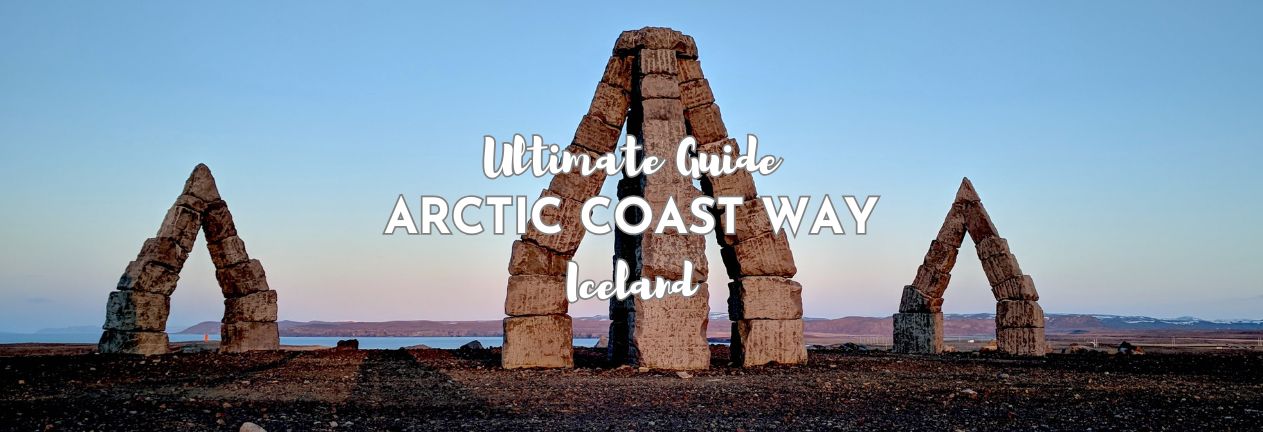
Iceland finished its Ring Road decades ago, but in 2019, following the success of the Ring Road as a tourism marketing campaign, it created something newer, a marked coastal route stringing together the far northern peninsulas that the Ring Road never actually touches. It’s called the Arctic Coast Way, and it’s for travelers who’ve already done the obvious stops and want the country’s more remote edges instead. Here’s our guide to the Arctic Coast Way…
THIS POST MAY CONTAIN COMPENSATED AND AFFILIATE LINKS MORE INFORMATION IN OUR DISCLAIMER
If you’re trying to work out what Iceland’s Arctic Coast Way actually is, here’s the rundown: what the route covers and how it’s signposted, the real difference between doing it in summer versus winter, the peninsulas and towns strung along it, how to get there, where to stay, and where to eat along the way.
PRACTICAL TRAVEL TIPS
- 🛡️ Get Travel Insurance: Civitatis includes medical expenses, repatriation, theft, luggage delays. No deductibles or upfront payments. Get a quote here.
- 🛏️ Sea view? Laundry? Private bath? Book a Room.
- 🔌 Be ready for the plug, socket & power situation.
- 📶 Get online EASILY & cheaply – One eSim for the world. Data never expires
What Is the Arctic Coast Way
The Arctic Coast Way, Norðurstrandarleið in Icelandic, is a signed coastal route running roughly 900 kilometers (560 miles) from Borðeyri in the west all the way to Bakkafjörður in the northeast. The route opened in June 2019, specifically to give travelers a reason to leave the Ring Road and actually explore the fishing villages, cliffs, lighthouses, and peninsulas along Iceland’s northern coast, rather than just glimpsing them from a distance on the way to Akureyri or Mývatn. The entire route is in North Iceland, and my guide to that region is here.
Before I start, let me cover the fact that you’ll get most out of this route if you’re self-driving, and so I’ve prepared a series of informational guides on that.
- Driving in Iceland, what you need to know
- Renting a car in Iceland – insurance, additional options and more
- Parking in Iceland – oh yes, this gets an entire post on its own
- Do you actually need a car in Iceland? I answer the question in this post.
- Iceland without a car
Arctic Coast Way — Two Different Routes
The honest answer to “how do I drive this?” changes completely depending on when you’re going, as there are two different routes – the Summer route and the Winter route. About one third of the Arctic Coast Way is unpaved, aka gravel roads, and some of them can be rough. The winter route makes more use of tunnels, say, on the Tröllaskagi peninsula.
The Arctic Coast Way Summer Route
In summer, the entire Arctic Coast Way as designed is accessible, every peninsula, every stretch of coastal road, open and drivable. This is the version of the Arctic Coast Way most people want. And it’s really the only time you can do the whole thing as one continuous route rather than picking sections. And you can easily drive it in a standard car.
The Arctic Coast Way Winter Route
In winter, sections of the Arctic Coast Way close, and while alternative roads exist, whether they’re actually passable varies from day to day. You’ll need to check road.is repeatedly rather than once. All rental cars in Iceland are fitted with studded tires from November until May, but I’d be renting a 4X4 if I wanted to do this route in winter. And taking full, all-risk insurance.
Some roads close, and some have daily snow clearing – this is the best source for figuring out which roads will be open if at all possible.
The Coasts of the Arctic Way in Iceland
Locals and the route’s own signage split the Arctic Coast Way into three loosely defined stretches, each with its own character rather than a strict boundary between them.
- The Coast of Sagas and Mythology runs through the stretch where Iceland’s medieval stories feel closest to the surface, saga-era farms, folklore tied to sea stacks and hidden valleys, and place names that still carry the weight of centuries-old tales. This is the part of the route where the landscape and the stories about it feel truly inseparable.
- The Coast of Fishing Towns and Heritage covers the working harbors and herring-era history that shaped this part of Iceland economically, small towns that once processed and exported fish by the boatload, now quieter but still built around the same industry that put them on the map in the first place.
- The Coast of Elemental Nature is the rawest stretch of the whole route: basalt sea stacks, seabird cliffs, volcanic mounds, and a sense of properly running out of country the further north and east you go. This is where the Arctic Coast Way earns its name most literally, closer to the Arctic Circle than almost anywhere else you can drive to on the Icelandic mainland.
The Peninsulas along the Arctic Coast Way
This route strings together a whole lot more peninsulas, villages, and quiet detours than I have the time to detail, and you have the time to read, so what follows are the highlights worth building your route around, in an area where there’s truly a lot more to find if you go looking.
The Tröllaskagi Peninsula
Tröllaskagi is one of the wildest, most underrated stretches of the entire Arctic Coast Way, dramatic mountains dropping straight into narrow fjords, tunnels connecting villages that used to take hours to reach by road. This is just a quick taste of what’s here; for the full picture, see our complete Skagafjörður & Tröllaskagi guide.
Herring Era Museum (Siglufjörður)
One of the best single-subject museums in the country, covering Siglufjörður’s herring boom through the 1940s and 50s in real depth, recreated fishing docks, an original processing factory, and the actual living quarters of the “herring girls” who worked here. One ticket also gets you into two smaller museums in town, the Folk Music Center and the Saga Fotografica photography museum, at no extra cost.
- Address of the Herring Era Museum: Siglufjörður town center.
- Opening Hours of the Herring Era Museum: June–August, daily 10:00–17:00; May and September, 13:00–17:00; October–April, by appointment.
- Ticket Price for the Herring Era Museum: 2,400 ISK adults, 1,300 ISK seniors. Skip the line and book Herring Era Museum tickets here.
Hofsós (Basalt Columns and Swimming Pool)
Hofsós is home to one of Iceland’s most photographed municipal pools, a cliff-edge swimming pool overlooking Skagafjörður itself, and right next door, the Staðarbjörg basalt columns run along the fjord’s edge in neat, dark ranks that look almost too regular to be natural.
- Address of Hofsós Swimming Pool: Hofsós, Skagafjörður.
- Opening Hours of Hofsós Swimming Pool: Summer opening from June 1 to August 23, weekdays 07:00-20:00, weekends 10:00-20:00. Winter opening from September 28 to May 30, weekdays 07:00-13:00 & 17:00-20:00, weekends 11:00-16:00.
- Ticket Price for Hofsós Swimming Pool: 1,400 ISK adults, 426 ISK children.
Grafarkirkja
Grafarkirkja is generally cited as the oldest surviving turf church in Iceland, tucked just outside Hofsós, with hand-carved wooden beams inside. The church has been closed to the public for preservation reasons in recent years, so treat this as a stop to view from outside, but it is in a glorious location.
- Address of Grafarkirkja: just outside Hofsós, on Route 76, Skagafjörður.
- Opening Hours of Grafarkirkja: not open to the public; viewable from outside only.
The Vatnsnes Peninsula
Vatnsnes is quieter again than Tröllaskagi, a stubby peninsula jutting out into Húnaflói bay, better known for a single rock formation than for any one town. This is just a taste of what’s here; for the full picture, see our North Iceland guide, which covers this peninsula alongside Akureyri and the wider Mývatn cluster.
Hvítserkur
Hvítserkur is a striking basalt sea stack that’s become one of the most photographed rock formations in the country, shaped, depending who you ask, like a dragon dipping its head into the sea. Low tide is the best time to walk down onto the black sand beach for a closer look, since the stack sits just offshore. Read more about the hike to see the stack and the best way to access it.
- Location of Hvítserkur: on the eastern shore of the Vatnsnes Peninsula.
- Opening Hours of Hvítserkur: none, accessible at any time.
- Ticket Price for Hvítserkur: free.
- Parking at Hvítserkur: 1,100 ISK via Parka app only.
The Icelandic Seal Center
Based in Hvammstangi, this small center focuses on the peninsula’s seal populations, both harbor and grey seals, and where to responsibly go looking for them along the shore nearby. It’s a quick stop rather than a half-day outing, worth it if seals are anywhere near a priority for your trip. There’s more on seals in Iceland in my guide to Icelandic Wildlife here.
- Address of the Icelandic Seal Center: in the town of Hvammstangi.
- Opening Hours of the Icelandic Seal Center: check current seasonal hours before you go.
- Ticket Price for the Icelandic Seal Center: from US$16 per person. Book Icelandic Seal Center tickets here
Akureyri
Akureyri sits close enough to this route that it’s worth folding into any Arctic Coast Way itinerary, even though it’s really North Iceland’s own hub rather than a stop on the coast road itself. Heart-shaped traffic lights, a proper aviation museum, whale watching right from town- we’ve covered all of it properly in our North Iceland guide, and that’s worth reading before you decide how much time to give it.
The Melrakkaslétta Peninsula
Melrakkaslétta is the remotest stretch of the entire Arctic Coast Way, and the one part of this route that doesn’t have a fuller guide anywhere else on this site, so it gets the full treatment right here. The peninsula’s informal name, “Sletta,” is short for the Plain of the Arctic Fox, and it sits about as far from anywhere as Iceland gets.
Arctic Henge
Iceland’s largest outdoor artwork, a monumental stone structure near Raufarhöfn, weaving together Icelandic folklore, literary history, and Norse mythology. It’s still being completed in stages, and standing in it on a clear day, with almost nothing else around for miles, is a truly different kind of experience than anything else on this list.
- Location of Arctic Henge: just outside Raufarhöfn, signposted off the coast road.
- Opening Hours of Arctic Henge: none, accessible at any time.
- Ticket Price for Arctic Henge: free.
Hraunhafnartangi
Mainland Iceland’s actual northernmost point, sitting just 3 kilometers (1.9 miles) south of the Arctic Circle itself. It was used as a harbor back in the Saga period, and today it’s a quiet, windswept spot rather than a major attraction, worth it specifically for the “furthest north you can stand on the mainland” claim.
- Location of Hraunhafnartangi: a detour off the coast road near Raufarhöfn.
- Opening Hours of Hraunhafnartangi: none, accessible at any time.
- Ticket Price for Hraunhafnartangi: free.
Rauðinúpur
A reddish, extinct volcanic mound with cliffs teeming with seabirds, guillemots, razorbills, and puffins among them, along with the world’s northernmost gannet colony. My guide to puffins in Iceland tells you where to see them and when. Read it here.
- Location of Rauðinúpur: on the peninsula’s western edge, off the coast road.
- Opening Hours of Rauðinúpur: none, accessible at any time.
- Ticket Price for Rauðinúpur: free.
Kópasker Earthquake Center
A small exhibition in the village of Kópasker, housed in the old school building, documenting a notable historical earthquake that struck the area, worth a stop if you want context for why this stretch of coast looks the way it does.
- Address of the Kópasker Earthquake Center: the school building, Kópasker village.
- Opening Hours of the Kópasker Earthquake Center: June 1–August 31, daily 13:00–17:00.
- Ticket Price for the Kópasker Earthquake Center: free.
Raufarhöfn Village
Once one of Iceland’s most important herring processing and export towns, now the country’s northernmost mainland village, and a diminishing one at that. Beyond the Arctic Henge nearby, the village itself has a swimming pool, a lighthouse, and, as an actually fun aside, colorfully painted trash cans scattered through town.
- Location of Raufarhöfn Village: on the coast road, the peninsula’s main settlement.
- Opening Hours of Raufarhöfn’s swimming pool: summer, Monday–Friday 14:00–19:30, Saturday–Sunday 12:00–16:30; winter, Monday/Wednesday/Friday 17:00–19:30, Saturday 14:00–16:30.
- Ticket Price for Raufarhöfn’s swimming pool: 1,300 ISK adults, 520 ISK children (6–17), 780 ISK seniors.
Map of the Arctic Coast Way
Here’s our map of the full route; you can also see the map here.
How to Get to the Arctic Coast Way
Most people join the route from Akureyri or Húsavík, either as an extension of a North Iceland stay or peeled off from the Ring Road proper. See our Ring Road guide for how this route fits into a longer trip, and our Diamond Circle guide if you’re combining this with that cluster too.
Where to Stay Along the Arctic Coast Way
- Hoepfner Historical House (Akureyri) puts you in a restored historic building right in the town’s oldest quarter, with tastefully decorated rooms, a kitchenette, and free WiFi, a short walk from the Hof Cultural Center. Check rates here.
- Siglo Hotel (Siglufjörður) is built directly into the town’s harbor, with fjord and mountain views from every room, plus a swimming pool, sauna, and geothermal hot pool on site. Book a room here.
- Northern Comfort Inn (Ólafsfjörður) — a free washing machine, a properly well-equipped self-catering kitchen, and plenty of space, individual bungalows each with their own private hot tub on the veranda. Check rates here at my favorite stay in Iceland!
- Hótel Húsavík — a solid base if you’re spending real time around Húsavík and the eastern stretch of this route, right in the town center, walking distance to the harbor, whale watching tours, and GeoSea. Book a room here
How Long Do You Need for the Arctic Coast Way
The full route is a multi-day undertaking, realistically the better part of a week if you want to do it properly rather than rush the coastal stretches. Most people do a section of it, Tröllaskagi and North Iceland, say, rather than the whole 900 kilometers (560 miles) in one trip.
Grocery Shopping Along the Arctic Coast Way
Akureyri has the best and biggest grocery shopping options by a clear margin, both Bónus and Krónan. Húsavík also has good options if you’re based further along the route and don’t want to backtrack.
Food & Drink Options Along the Arctic Coast Way
Greifinn, at Glerárgata 20 in Akureyri, is a solid, well-regarded choice for a proper sit-down meal. Further along the route, Naustið, on Ásgarðsvegur in Húsavík, is a family-run seafood restaurant worth planning a stop around.
FAQs on the Arctic Coast Way
Got questions about the Arctic Coast Way? Here are quick answers to what we’re asked most.
How long is the Arctic Coast Way?
The Arctic Coast Way is roughly 900 kilometers (560 miles), running from Borðeyri in the west to Bakkafjörður in the northeast.
Is the Arctic Coast Way off the beaten path?
Yes, truly so. It was created specifically to draw travelers off the Ring Road and into parts of North Iceland most Iceland itineraries never touch.
Do you need a 4×4 for the Arctic Coast Way?
No, you don’t need a 4×4 for the summer route; standard cars handle it fine. Winter is a different question; studded tires are mandatory on all rental cars that time of year, and a 4×4 gives real peace of mind even where it’s not strictly required. See what the difference in price is here.
Can you combine the Arctic Coast Way with the Diamond Circle?
Yes, and quite naturally. It’s a popular trip to end up covering half of the Arctic Coast Way and half of the Diamond Circle on the same trip, particularly around Húsavík and Mývatn, where the two routes actually overlap. See our Diamond Circle guide and our North Iceland guide for how all of this fits together.
Is it easy to add the Arctic Coast Way onto the Iceland Ring Road?
Yes, most people join it as a detour from the Ring Road around Akureyri or Húsavík rather than driving it start to finish as a separate trip. A section of the Arctic Coast Way adds naturally onto a wider Ring Road itinerary without much extra planning.
Is the Arctic Coast Way well-marked and easy to follow?
Yes, it’s an officially signed route, easy enough to follow in summer. Winter is the exception; sections close and detours aren’t always obvious, so read road.is rather than the signage alone that time of year.
ICELAND TRAVEL RESOURCES
AIRPORT TRANSFERS
24/7 pickup & drop off. Trusted, local English speaking drivers. Prebook & prepay online with cards.
Book a Transfer
HOTELS AND APARTMENTS
See choices here
Rooms with a view? Budget rooms? Need a washing machine? The best choice of hotels & apartments.
TOURS & ATTRACTIONS
Most excursion choices, small group tours, skip-line tickets, free cancellation and top local guides.
Top options here.
CAR RENTAL OPTIONS
Choose cars here
Best choice of vehicles, automatics, large or small cars, child seats. Book early for more options.
Final Words on the Arctic Coast Way
The Arctic Coast Way isn’t for a first trip to Iceland, and it doesn’t need to be. It’s for you if you’ve already done the Golden Circle and the South Coast and want Iceland’s truly remote edges instead: herring museums, basalt sea stacks, an artwork built from stone standing alone near the Arctic Circle. Give it the time it deserves, and it delivers exactly what it promises.
ASocialNomad is a participant in the Amazon Services LLC Associates Program, an affiliate advertising program designed to provide a means for sites to earn advertising fees by advertising and linking to amazon.com, amazon.co.uk, and amazon.ca. Amazon and the Amazon logo are trademarks of Amazon.com, Inc. or its affiliates. As an Amazon Associate, I earn from qualifying purchases.

