
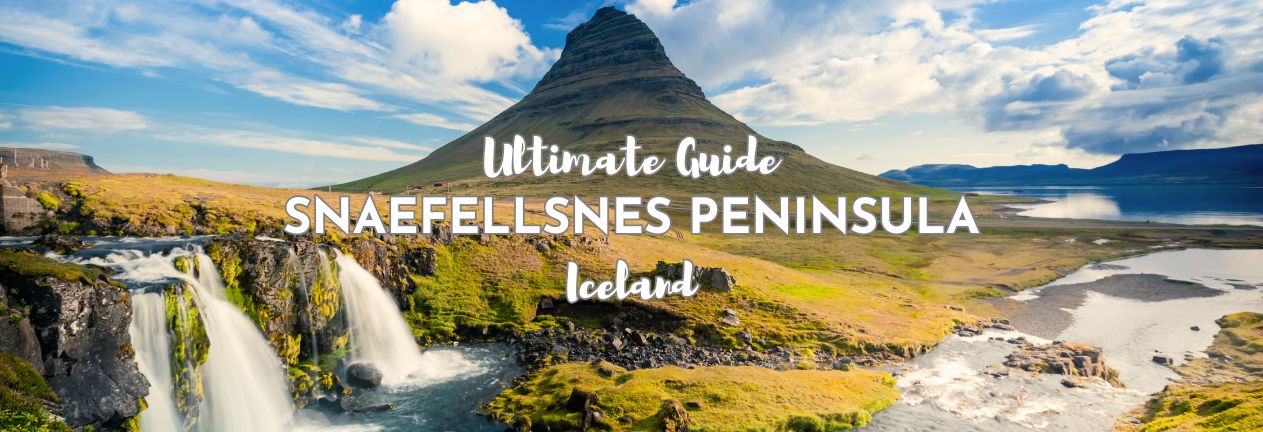
Some places in Iceland ask you to pick a type of attraction: glaciers or beaches, waterfalls or lava fields. Snaefellsnes doesn’t do that. You’ve got the lot. This one peninsula, a couple of hours north of Reykjavik, includes a glacier-capped volcano, black pebble beaches, hot springs with no facilities whatsoever, and a mountain that’s been photographed more than almost anywhere else in the country. It’s not called “Iceland in Miniature” for nothing. Here’s our Snaefellsnes Peninsula travel guide…
THIS POST MAY CONTAIN COMPENSATED AND AFFILIATE LINKS MORE INFORMATION IN OUR DISCLAIMER
If you’re putting together a Snaefellsnes travel guide of your own, here’s what this one covers: what to actually see along the loop, how to get here, whether a day trip or a self-drive stay makes more sense for you, where to stay, how long to spend here, and where to eat when your options are a lot less than they were back in Reykjavik. This covers Snaefellsnes things to do properly, not just the five stops every tour bus already takes you to.
PRACTICAL TRAVEL TIPS
- 🛡️ Get Travel Insurance: Civitatis includes medical expenses, repatriation, theft, luggage delays. No deductibles or upfront payments. Get a quote here.
- 🛏️ Sea view? Laundry? Private bath? Book a Room.
- 🔌 Be ready for the plug, socket & power situation.
- 📶 Get online EASILY & cheaply – One eSim for the world. Data never expires
What to See on Snaefellsnes
There are twenty stops below, and they run anti-clockwise starting from Reykjavik, roughly in the order you’ll reach them. If you’re doing this as a single day trip, be honest with yourself now: you will NOT comfortably do all twenty in one day and still enjoy any of them. Pick what matters the most to you and let the rest go, rather than turning this into a sprint.
EASIEST WAY TO VISIT
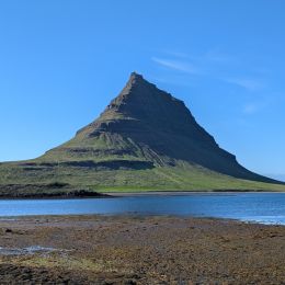
Discover Iceland in miniature on the Snæfellsnes Peninsula, test your strength at the “lifting stones” of Djúpalónssandur and see the seal colony and charming farm of Ytri-Tunga on this small group tour from Reykjavik
The Bjarnarhöfn Shark Museum
This is a small, family-run museum on the northern coast dedicated entirely to hákarl, Iceland’s fermented shark, how it’s made, why it’s made that way, and yes, a chance to taste it yourself if you’re brave enough. It’s a strange, honest introduction to one of Iceland’s least loved foods. And it’s a delightful place.
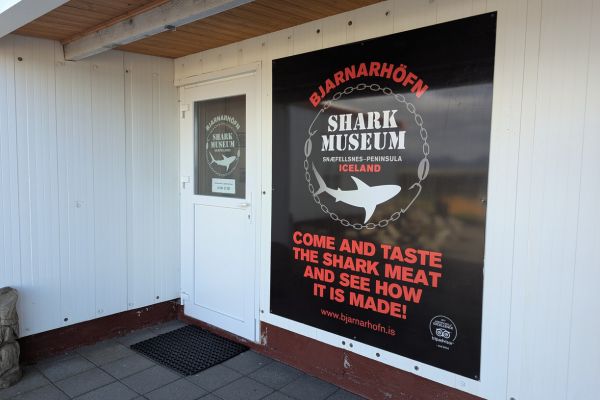
There truly is nothing else out here, just the museum and the family farm and home. You’ll learn about Greenland sharks and traditional Icelandic food culture, see the historic curing sheds where the shark hangs for months, and then take a guided shark tasting alongside a shot of Brennivín, the traditional chaser. There’s more info on Brennivin in my guide to alcohol in Iceland and hakarl? The fermented shark? You can read about that in my guide to food in Iceland here.
- How to get to the Bjarnarhöfn Shark Museum: signposted just off Route 54 on the peninsula’s north side.
- How long to spend at the Bjarnarhöfn Shark Museum: 30-45 minutes, including the tasting.
- Entrance Fee to the Bjarnarhöfn Shark Museum: 2,200 ISK per person, including tasting.
- Parking at the Bjarnarhöfn Shark Museum: free on site.
Kirkjufell
Kirkjufell is the most photographed mountain in Iceland, arrowhead-shaped, standing alone near Grundarfjörður, with the small tiered Kirkjufellsfoss waterfall sitting in the foreground of practically every shot. It picked up extra fame as “Arrowhead Mountain” in Game of Thrones, which hasn’t hurt the crowds any. There’s a viewing platform, which gives you a great view of the falls with the mountain behind it.
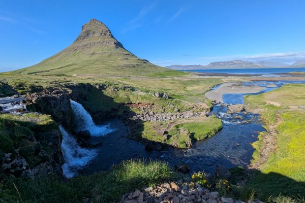
Sunrise and sunset both transform the scene; the light changes the color of the rock through the day, and in winter, the northern lights sometimes appear directly behind the peak, making this one of the most-searched aurora photography spots in the country.
- How to get to Kirkjufell: just outside Grundarfjörður, signposted off Route 54.
- How long to spend at Kirkjufell: 30-45 minutes at the viewpoint and waterfall.
- Entry to Kirkjufell: free.
- Parking at Kirkjufell: There are two parking options here. The first is paid, and closer to the falls, 1,400 ISK (Easypark). The free parking is slightly further away, at this map link.
Grundarfoss Waterfall
Grundarfoss is to be found just outside its namesake town, and it’s easy to get to, a straightforward 3-kilometer (1.9-mile) round trip hike rather than anything technical, with horses from a neighboring farm sometimes keeping you company on the way up (don’t feed them). The waterfall drops in two stages down a mossy hillside, framed by steep valley walls on either side, and the trail follows the river the whole way up, easy to find even without a map. It’s considerably quieter than Kirkjufellsfoss down the road; most visitors never make the short detour, which makes it a properly peaceful spot even in peak summer.
- How to get to Grundarfoss Waterfall: the trailhead starts right off Route 54.
- How long to spend at Grundarfoss Waterfall: around 45 minutes round trip.
- Entry to Grundarfoss Waterfall: free.
- Parking at Grundarfoss Waterfall: free at the trailhead.
The Murals of Hellissandur
Hellissandur turned itself into an open-air gallery, with more than 40 large-scale murals painted across the village’s buildings, part of an annual street art festival that’s been running for years. It’s an odd, colorful contrast to the volcanic scenery everywhere else on the peninsula. We stayed in Hellissandur, in the old bookstore apartment, which is comfortable, quirky, and well positioned. Artists from Iceland and abroad contribute new murals most years, ranging from realistic portraits to abstract, colorful designs covering entire building facades, and the collection keeps growing, so even repeat visitors will likely find something new each summer.
- How to get to the Murals of Hellissandur: walk the village streets of Hellissandur; most murals are within a few minutes of each other.
- How long to spend at the Murals of Hellissandur: 30-60 minutes wandering.
- Entry to the Murals of Hellissandur: free.
- Parking at the Murals of Hellissandur: free on the street.
The GK-2 Boat Wreck
The GK-2 is a rusting old fishing boat, left to the elements on the shore near Hellissandur, not as famous as the South Coast’s DC-3 wreck, but it has the same appeal, an abandoned piece of machinery slowly losing its argument with the weather. The fishing boat was built in 1967 in Akureyri and suffered damage at sea in 2017; it was eventually towed to the beach, where it remains.
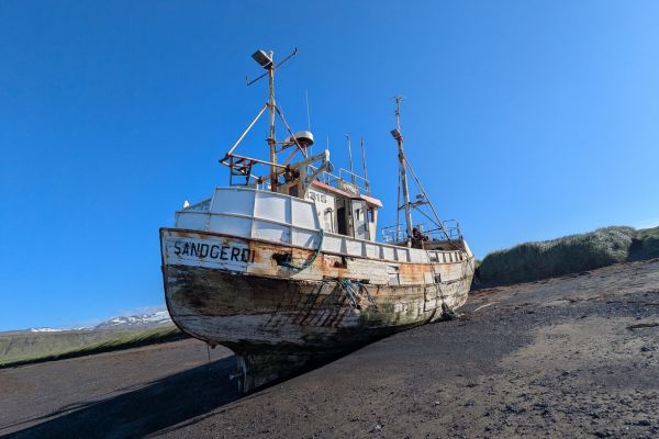
It makes a striking subject for photography, especially at sunset when the rusted hull catches the light, and it’s become a minor pilgrimage stop for photographers touring the peninsula specifically for shots like this one.
- How to get to the GK-2 Boat Wreck: near Hellissandur, a short walk from the road.
- How long to spend at the GK-2 Boat Wreck: 10-15 minutes.
- Entry to the GK-2 Boat Wreck: free.
- Parking at the GK-2 Boat Wreck: free.
Saxhóll Crater
This is one of the easiest volcano craters to visit in Iceland. It’s also free to visit and free to park here. Saxhóll is a red volcanic crater inside Snæfellsjökull National Park. There’s a metal staircase bolted onto the side of the crater, so it’s an easy walk up. There’s also a couple of platforms at the top with information. It’s one of the quickest and easiest volcano experiences in the whole country.
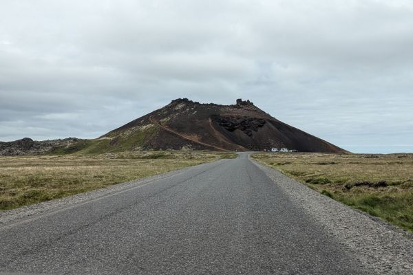
The crater rises 109 meters (358 feet), and the just under 400 steps on the staircase are shallow and easy to navigate. From the rim, the views stretch across the surrounding lava field all the way to the coast on a clear day.
- How to get to Saxhóll Crater: signposted off Route 574 inside the national park.
- How long to spend at Saxhóll Crater: 15-20 minutes, including the climb.
- Entry to Saxhóll Crater: free.
- Parking at Saxhóll Crater: free at the base.
Snæfellsjökull Glacier
This glacier-capped stratovolcano gives the whole peninsula its name and is famous in literary fiction; Jules Verne used it as the entrance to the center of the Earth. On a clear day you can see it from Reykjavik, across the bay. Getting onto the ice itself means a guided glacier hike; this isn’t something to attempt alone. The volcano last erupted roughly 1,800 years ago and remains classified as active rather than extinct by geologists. Local folklore also treats the glacier as one of Iceland’s main sources of natural energy, and some visitors still come specifically hoping to feel it.
There’s more on Iceland’s glaciers in my guide here.
- How to get to Snæfellsjökull Glacier: visible across most of the national park, guided hikes typically depart from Arnarstapi.
- How long to spend at Snæfellsjökull Glacier: viewing from below, 15-20 minutes; a full guided summit hike runs closer to 7 hours.
- Entry to Snæfellsjökull Glacier: free to view; guided glacier summit hikes cost around $432 (roughly 60,000 ISK) per person for the full 7-hour route; shorter, easier hikes lower on the mountain start from around $60. The most popular way to visit is to take an ATV tour over the lava fields and onto the glacier.
- Parking at Snæfellsjökull Glacier: free at the main viewpoints.
Vatnshellir Lava Cave
An 8,000-year-old lava tube you descend into via a spiral staircase, about 35 meters underground, with really vivid mineral colors on the cave walls once you’re down there. It’s guided-only, no wandering in on your own. The tube formed when a river of molten lava drained away, leaving the hollow tunnel behind, and different sections show distinct color bands, deep reds, blacks, and oranges, caused by varying mineral content in the surrounding rock.
Guides carry proper lighting and explain the cave’s formation as you go, and the temperature underground stays a consistent, chilly few degrees regardless of the weather outside, so bring a proper layer even in summer.
- How to get to Vatnshellir Lava Cave: on Route 574 within the national park, tours meet at the visitor hut.
- How long to spend at Vatnshellir Lava Cave: about 50 minutes for the full tour.
- Entry to Vatnshellir Lava Cave: 5,900 ISK for adults, 4,600 ISK for seniors and students, 2,600 ISK for teenagers (12-17), free for children under 12. You will need to prebook entrance; you can do that here
- Parking at Vatnshellir Lava Cave: free at the meeting point.
Djúpalónssandur Beach
This is a black pebble beach with an interesting history attached to it. There are four “lifting stones” here once used to test a fisherman’s strength before he’d be hired onto a crew. Add that to the scattered rusting remains of the Epine GY7, a British trawler out of Grimsby that wrecked here on the night of March 13, 1948, with the loss of 14 of her 19 crew. It’s popular enough that marked paths and barriers have gone in to manage the crowds and protect the fragile shoreline. The four stones are named Fullsterkur (full strength), Hálfsterkur (half strength), Hálfdrættingur (weakling), and Amlóði (useless), and you can still try lifting them today.
- How to get to Djúpalónssandur Beach: off Route 574, a short walk down from the car park.
- How long to spend at Djúpalónssandur Beach: 30-45 minutes.
- Entry to Djúpalónssandur Beach: free.
- Parking at Djúpalónssandur Beach: free, but arrive early in summer; the lot fills.
Lóndrangar
The attractions here are two towering basalt sea stacks, which are remnants of an old volcanic crater, rising straight out of the surf. Thousands of seabirds nest on the cliffs nearby, so bring binoculars even if you’re not usually a birdwatcher. The taller of the two stacks reaches 75 meters (246 feet), the shorter one 61 meters (200 feet). Local folklore states that trolls once lived inside them, turned to stone when caught out by daylight. This appears to be a common tale in Icelandic troll tales generally. Take the short boardwalk trail to a viewpoint overlooking both stacks and the surrounding cliffs, and the contrast between black rock, green clifftop grass, and wheeling seabirds makes this one of the more photogenic stops on the peninsula.
- How to get to Lóndrangar: signposted off Route 574, close to Djúpalónssandur.
- How long to spend at Lóndrangar: 20-30 minutes.
- Entry to Lóndrangar: free.
- Parking at Lóndrangar: free.
Interdimensional Hopscotch
Officially called Víddaflakk, this is one of Iceland’s odder roadside curiosities, a small plaque telling the invented story of a woman named Eliala Mei-Ning, who saved a child known throughout an imagined parallel universe. It’s art, not history, and it’s exactly the kind of quietly weird thing worth a two-minute detour for. The installation is the work of an Icelandic artist, part of a small scattering of similarly strange, fictional monuments dotted around the country, each treated with a completely straight face despite describing events that never happened.
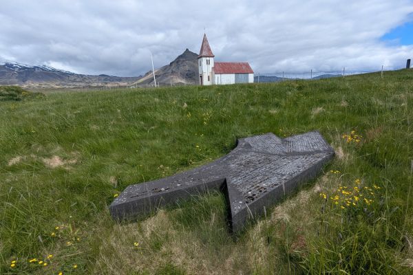
There’s no visitor center, no gift shop, just a plaque and a story, which is exactly the point. You can read more about it here.
If the grass in the field where the plaque is, you’ll have to search around, as really, this isn’t very obvious at all.
- How to get to Interdimensional Hopscotch: near Rauðfeldsgjá, on the southern side of the peninsula.
- How long to spend at Interdimensional Hopscotch: 5-10 minutes.
- Entry to Interdimensional Hopscotch: free.
- Parking at Interdimensional Hopscotch: free, park at the gates to the church (here) and walk down the side of the fence to find the plaque.
Arnarstapi Cliffs
Arnarstapi is a tiny fishing hamlet with a lovely coastal walking path linking it to neighboring Hellnar, basalt cliffs, crashing surf, and a stone monument to Bárður Snæfellsás, the half-troll guardian spirit locals still associate with the whole region. The path runs along dramatic cliff edges the whole way, with several natural rock arches and blowholes visible from the trail, and arctic terns nest here in summer.
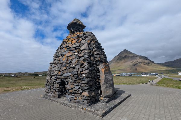
You can walk right by the edge of the cliff and look down on some of the nests. Walk over the rock arch, which looks scarier from a distance than when you’re on top of it! The harbor itself is small and working, still used by local fishing boats rather than purely for tourism.
- How to get to Arnarstapi Cliffs: on Route 574, on the peninsula’s south side.
- How long to spend at Arnarstapi Cliffs: an hour, more if you walk the full trail to Hellnar.
- Entry to Arnarstapi Cliffs: free.
- Parking at Arnarstapi Cliffs: free at the harbor and by the Arnarstapi Center and Snjófell Restaurant.
Gatklettur
A natural stone arch along the Arnarstapi-Hellnar coastal path, framed nicely by the waves crashing through the hole in the middle. It’s a short stop on the same walk as the cliffs above, not really a separate stop. The arch has been carved slowly over centuries by wave erosion working on a weaker seam of rock, and at high tide the sea passes clean through the opening, while at low tide you can see the base of the arch more clearly from the rocks below.
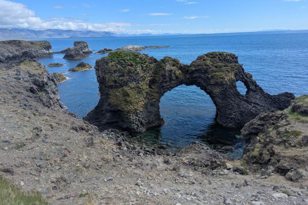
It’s one of the most-photographed single features on the whole coastal trail, and well-made trails are leading to it.
- How to get to Gatklettur: along the Arnarstapi-Hellnar coastal trail.
- How long to spend at Gatklettur: 10 minutes.
- Entry to Gatklettur: free.
- Parking at Gatklettur: free at either end of the trail. It’s easiest to park by the Arnarstapi Center and Snjófell Restaurant and make a short circular walk.
Eldborg Crater
This crater is a near-perfectly symmetrical spatter cone rising out of the shrubland, with an easy-ish hike up to the rim and properly wide views over the surrounding lava field once you’re up there. The final stretch has a chain to help you up the steepest bit. Eldborg means “fortress of fire,” which is a fitting name for a crater whose walls rise a uniform 60 meters above the surrounding plain, formed in a single eruption roughly 5,000-6,000 years ago, well before Iceland was settled. The crater’s rim is circular, walkable all the way around, and the lava field beneath it, Eldborgarhraun, stretches for miles in every direction, a reminder of just how much material a single eruption can produce.
- How to get to Eldborg Crater: signposted off Route 54, southern side of the peninsula.
- How long to spend at Eldborg Crater: around 2 hours round trip.
- Entry to Eldborg Crater: free.
- Parking at Eldborg Crater: free at the trailhead.
Búðakirkja (the Black Church)
After Kirkjufell, this small 19th-century wooden church, painted entirely black, standing alone against the Búðahraun lava field, is the most popular stop on Snaefellsnes. And all the tours will stop here. It’s usually locked, opening only for weddings and local ceremonies, but the outside alone is worth the stop, especially with Snæfellsjökull visible behind it on a clear day.
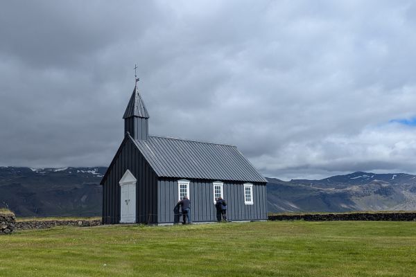
The first church here was built in 1703, torn down in 1816 by order of the Danish king, then rebuilt in 1848 by Steinunn Sveinsdóttir, a local widow, against the wishes of the parish. It’s since had further restoration work, most recently in the late 1980s. The stark black-against-white-and-green setting makes it one of the more striking, minimalist photo subjects on the entire peninsula.
Be wary when driving here, as once you come off Route 54, the road is rather windy, and there are usually a lot of sheep in the area.
- How to get to Búðakirkja: a short detour off Route 54 near Búðir.
- How long to spend at Búðakirkja: 15-20 minutes.
- Entry to Búðakirkja: free to view from outside.
- Parking at Búðakirkja: free.
Ytri Tunga
Snaefellsnes’s one golden sand beach is an odd contrast to all the black volcanic sand elsewhere in the country. It is reliably the peninsula’s best spot for seal watching. Harbor and grey seals haul out on the rocks close enough to shore that you don’t need a boat to see them properly. For more on where else to spot them, see our wildlife guide.
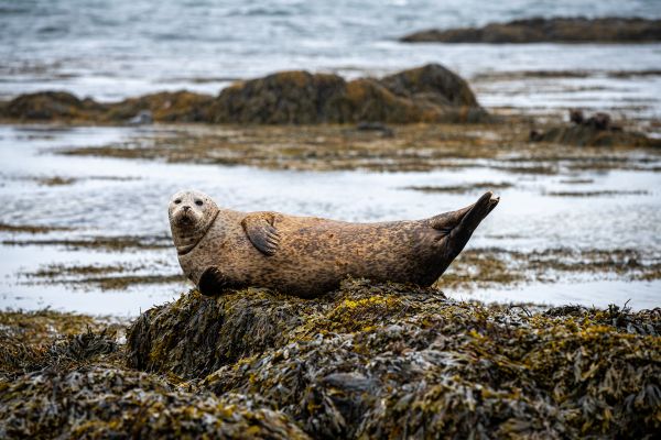
The best sightings tend to come around low tide, when more of the small rocky islets are exposed for the seals to rest on, and pupping season in summer means young seals are often visible alongside the adults. Bring a zoom lens if you have one, as you should stay at least 100 meters (328 feet) away, especially if there are young seals around.
- How to get to Ytri Tunga: signposted off Route 54, southern side.
- How long to spend at Ytri Tunga: 30-45 minutes.
- Entry to Ytri Tunga: free.
- Parking at Ytri Tunga: free.
Ölkelduvatn Mineral Spring
This naturally carbonated mineral spring is a real rarity in Iceland, tucked away and easy to miss if you’re not specifically looking for it. It’s not a bathing spot, rather an pipe with naturally slightly fizzy water coming out of it. However, you might miss the fix as the spring water is so rich in iron and other minerals that all you’ll notice is the metallic taste. It also tinges the surrounding rocks rather red.
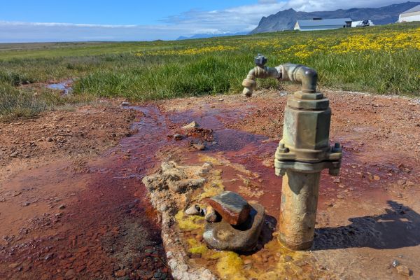
There’s no signage of any real substance here, no facilities, and nothing commercial about it; it’s simply a spot where the ground itself produces naturally sparkling water, worth a curious taste rather than a serious detour.
- How to get to Ölkelduvatn Mineral Spring: a short detour off Route 54.
- How long to spend at Ölkelduvatn Mineral Spring: 10-15 minutes.
- Entry to Ölkelduvatn Mineral Spring: free.
- Parking at Ölkelduvatn Mineral Spring: There’s an honesty box, asking for 300 ISK in cash. It’s the only place in Iceland that we found asking for cash. Read my guide on how to pay in Iceland here.
Gerðuberg Cliffs
This long wall of hexagonal basalt columns, some reaching 14 meters high and running for over half a kilometer along the cliff face, is a popular free stop on Snaefellsnes. It looks almost too geometric to be natural, which is exactly why it draws a steady stream of visitors. The columns formed as thick lava cooled slowly and evenly, cracking into the same hexagonal pattern seen at basalt formations elsewhere in Iceland and around the world, like Northern Ireland’s Giant’s Causeway. Basalt Columns are one of Iceland’s unique features – there are more here than anywhere else in the world. Read about more unique things to see and do in my guide here.
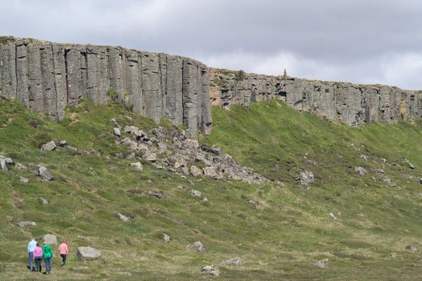
Unlike more famous basalt sites, there’s no crowd management here, no boardwalk, just a wide-open field where you can walk right up to the base of the columns and appreciate the scale up close.
The road to get here is gravel and pretty rough as you get closer. You don’t need a 4×4, just take it slow.
- How to get to Gerðuberg Cliffs: a short gravel-road detour off Route 54.
- How long to spend at Gerðuberg Cliffs: 20-30 minutes.
- Entry to Gerðuberg Cliffs: free.
- Parking at Gerðuberg Cliffs: free.
Landbrotalaug Hot Springs
Landbrotalaug Hot Spring is a proper wild hot spring. There’s no changing room, no toilet, nowhere to leave your things, just two small pools of naturally hot water down a gravel track. The temperature swings unpredictably between roughly 34°C and 40°C (93°F to 104°F), which you might find charming, but hey, this is nature. Check the temperature with your hands before stepping in. That nature also means that the pools are generally muddy as well. My guide to the top free hot springs to visit in Iceland is here.
The pools are right in a farmer’s field, properly unmarked and unmanaged, which is exactly why they’ve become a favorite among travelers looking for a soak with none of the infrastructure, and none of the crowds, of somewhere like the Blue Lagoon. Bring your own towel and be prepared to share the pool if other visitors arrive while you’re soaking.
The last 1.5 kilometers (1 mile) of the road to the parking area is pretty rough.
- How to get to Landbrotalaug Hot Springs: down a gravel detour off Route 54, follow signs for Stóra-Hraun.
- How long to spend at Landbrotalaug Hot Springs: 30-60 minutes, longer if you’re soaking.
- Entry to Landbrotalaug Hot Springs: free.
- Parking at Landbrotalaug Hot Springs: free, gravel lot, space for about ten cars.
The Red Volcanic Sands off Route 55
Not long after you rejoin Route 54 (assuming you stopped at Landbrotalaug), there’s a turn-off for Route 55, on the left. Drive along this gravel road for 3 kilometers (1.86 miles), and there’s a smaller road, equally gravel, that goes into the lava field here. It’s a single-track gravel road, with little to no turning points – and the lava here is brutal; you won’t be going off-road at all here.
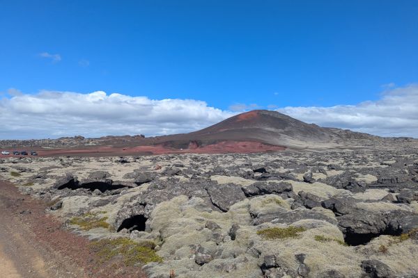
It’s just a short drive, and you’ll reach the red volcanic sands. If you’re lucky, you’ll have this area to yourself. Be wary of soft sand, but it’s a fabulous place for a lunch stop, or just photographs. The road here is a genuine road; it’s not off-road, but it’s spectacular, and you will feel as though you’re driving through a lava flow. Map pointer for red volcanic sands off Route 55: here
Map of Attractions on the Snaefellsnes Peninsula
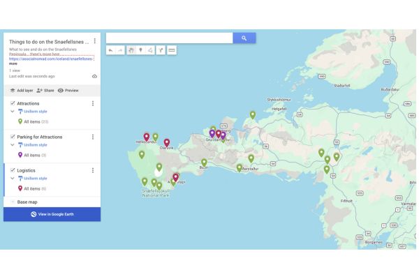
Here’s our map of all twenty stops on the Snaefellsnes loop; you can also see the map here.
How to Visit the Snaefellsnes Peninsula
You’ve basically got two ways to do this: a day trip out of Reykjavik, or self-driving the loop yourself, and the right answer depends more on your comfort behind the wheel than anything else.
Snaefellsnes Day Trip from Reykjavik
A guided day trip takes the navigation and pacing entirely off your plate; someone else worries about the roads while you look out the window. The tradeoff is time; the full loop realistically takes 8-10 hours round trip from Reykjavik, although some take 12 hours. A single-day version means picking highlights rather than seeing everything on this list, and you’ll be moving through the popular stops on the same schedule as every other tour bus. See our day trips from Reykjavik guide for more on how this compares to the other big day trip options.
Self-Driving Snaefellsnes
Driving yourself gives you full control over pacing, and the real ability to time popular spots like Kirkjufell for early morning or late evening, when the tour buses haven’t arrived yet or have already gone. It also means you can actually stop for the quieter detours on this list, the ones a bus schedule has no time for. The main loop, Route 54, is paved and fine in a standard car year-round, though winter adds real caution around ice and shorter daylight. A 4×4 only becomes necessary for the F-roads higher up toward the glacier, and those are summer-only anyway.
How to Get to Snaefellsnes
From Reykjavik, take Route 1 north; most people use the Hvalfjörður tunnel to save time, emerging near Borgarnes. From there, turn onto Route 54, which becomes the main artery tracing the peninsula’s coastline. You should allow around two hours for the drive out before you’ve even started the loop itself. If you prefer the scenic route, then take Route 47, around Hvalfjörður, for some spectacular views and the odd waterfall along the way. Taking this route means you can also visit the War and Peace Museum (see my guide to Iceland’s Museums here)
Where to Stay to Explore Snaefellsnes
Accommodation options are spread along this route compared to somewhere like the South Coast, so it’s worth booking ahead rather than assuming you’ll find something on the day. Assuming accommodation on the day, unless you’re camping, is not really a thing in Iceland, especially if you’re traveling in high season. Read my guide to Iceland accommodation here.
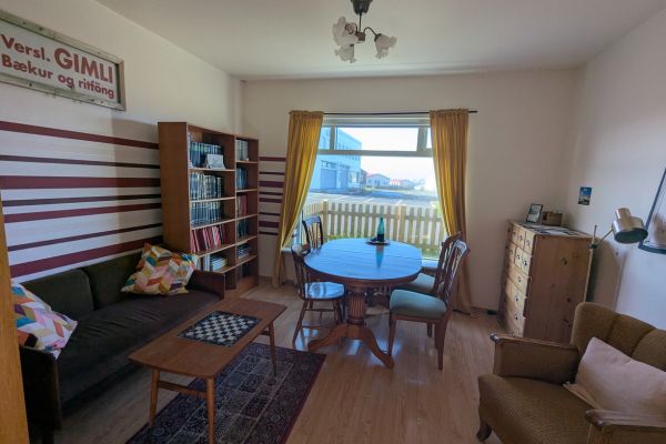
- The Freezer Apartments (Hellissandur/Ólafsvík) — we stayed here ourselves, in the Old Bookstore apartment specifically, and would happily book it again.
- Adventure Hellissandur — On our shortlist for this area, an excellent location
- Arnarstapi Cottages — on the shortlist if you’d rather base yourself further south, closer to the Arnarstapi/Hellnar trail and Eldborg.
- Bjargarsteinn Boutique Stay (Grundarfjörður) — also on the shortlist, useful if Kirkjufell is your main priority and you want to be close for a sunrise or sunset shot.
How Long to Visit Snaefellsnes
A rushed single day will get you around the highlights of Snaefellsnes, but doesn’t leave much room to actually enjoy them. Two days is the minimum if you want to do this properly, hiking a bit, soaking in Landbrotalaug, if that’s your thing, and not just photographing everything from the car window.
Grocery Shopping on Snaefellsnes
Stykkishólmur, Grundarfjörður, and Ólafsvík all have small supermarkets worth timing a stop around if you’re self-catering.
Food & Drink Options on Snaefellsnes
Food options here are truly limited compared to somewhere like Reykjavik, so self-catering is worth planning around rather than assuming you’ll find somewhere decent every night. Our self-catering guide covers tips and easy recipes, our accommodation guide covers what kind of stay actually gives you a kitchen to use, and our guide to saving money in Iceland has more on why this matters for your budget.
When you do want a proper meal out, two are worth planning around specifically.
- Matarlist (Grundarbraut 2, 355 Ólafsvík, Iceland): This is a well-reviewed spot serving fresh, local dishes. matarlist.is
- Stapinn, in Arnarstapi (Fellaslóð 1, 356 Arnarstapi, Iceland) is a family-run restaurant and café, open seasonally (roughly May through September), good honest food at fair prices, and one of only a handful of places to eat in the village at all.
FAQs on the Snaefellsnes Peninsula
Got questions about visiting Snaefellsnes? Here are quick answers to what we’re asked most.
Why is Snaefellsnes called “Mini Iceland”?
Snaefellsnes is often called “Iceland in Miniature” because it packs glaciers, lava fields, black and gold sand beaches, waterfalls, hot springs, and fishing villages into one 90-kilometer (56-mile) peninsula, more or less every landscape type Iceland is known for, condensed into a single loop.
Can you do Snaefellsnes as a day trip from Reykjavik?
Yes, but honestly, it’s a long one, 8-10 hours round trip if you want to see the main highlights rather than rush past them. If you can manage an overnight instead, you’ll enjoy it more.
What’s the most photographed spot on Snaefellsnes?
Kirkjufell is the most photographed spot on Snaefellsnes. Between the mountain’s shape and the waterfall in front of it, it’s one of the most photographed spots in the entire country, not just the peninsula. It’s closely followed by Búðakirkja (the Black Church)
Is Snaefellsnes worth it if I’m also doing the Ring Road?
Yes, it sits just off the main Ring Road route through Borgarnes, so it’s a natural add-on rather than a big detour. Genuinely worth the extra day or two if your itinerary allows it.
How long is the drive around the whole peninsula?
The coastal loop itself is somewhere between 250 and 300 kilometers (155 to 186 miles), roughly four to five hours of driving without stops. Add the two hours each way from Reykjavik, and you can see why an overnight stay makes more sense than a single rushed day.
ICELAND TRAVEL RESOURCES
AIRPORT TRANSFERS
24/7 pickup & drop off. Trusted, local English speaking drivers. Prebook & prepay online with cards.
Book a Transfer
HOTELS AND APARTMENTS
See choices here
Rooms with a view? Budget rooms? Need a washing machine? The best choice of hotels & apartments.
TOURS & ATTRACTIONS
Most excursion choices, small group tours, skip-line tickets, free cancellation and top local guides.
Top options here.
CAR RENTAL OPTIONS
Choose cars here
Best choice of vehicles, automatics, large or small cars, child seats. Book early for more options.
Final Words on the Snaefellsnes Peninsula
Snaefellsnes doesn’t ask for as much time as the Ring Road proper, but it packs a good punch. I’ve outlined twenty stops on one loop, and honestly, you could skip half of them and still leave impressed. Give Snaefellsnes the two days it deserves if you can, and you’ll come away with an honestly fuller sense of what Iceland can pack into one small corner of itself. There’s lots of this peninsula that you’ll feel that you have to yourself. And it’s worth it for that alone.
ASocialNomad is a participant in the Amazon Services LLC Associates Program, an affiliate advertising program designed to provide a means for sites to earn advertising fees by advertising and linking to amazon.com, amazon.co.uk, and amazon.ca. Amazon and the Amazon logo are trademarks of Amazon.com, Inc. or its affiliates. As an Amazon Associate, I earn from qualifying purchases.

