
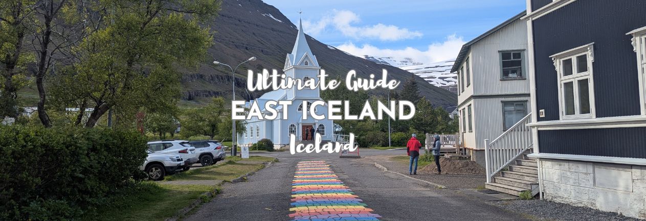
Most Ring Road itineraries treat East Iceland as the bit between the South Coast and Mývatn, a stretch of fjords to get through rather than to actually see. In my view, that’s a mistake, and this is the region that rewards you most for slowing down and treating it as a destination rather than a corridor. Here’s our East Iceland travel guide…
THIS POST MAY CONTAIN COMPENSATED AND AFFILIATE LINKS MORE INFORMATION IN OUR DISCLAIMER
If you’re planning a stop in or a route through East Iceland, here’s what this guide covers: what to actually see along the route, how to get here (there’s more than one way, including one that no other region in this guide can offer), where to stay and how long to spend, and where to buy groceries and eat well once you’re out here, since the options are fewer compared to Reykjavik or the South Coast.
PRACTICAL TRAVEL TIPS
- 🛡️ Get Travel Insurance: Civitatis includes medical expenses, repatriation, theft, luggage delays. No deductibles or upfront payments. Get a quote here.
- 🛏️ Sea view? Laundry? Private bath? Book a Room.
- 🔌 Be ready for the plug, socket & power situation.
- 📶 Get online EASILY & cheaply – One eSim for the world. Data never expires
What to See in East Iceland
I’m starting this guide from Höfn, and running anti-clockwise starting from Vestrahorn, just east of Höfn, and finishing at Stuðlagil Canyon inland. One thing worth knowing before you start: East Iceland’s reindeer, the East Iceland Heritage Museum, and the Reindeer Park near Egilsstaðir are detailed in our wildlife guide, but since reindeer live nowhere else in Iceland, I’m covering the full picture here too rather than just pointing elsewhere.
East Iceland’s Wild Reindeer
East Iceland is the only place in the country where you’ll find reindeer, but wild reindeer aren’t something most people associate with Iceland at all. They aren’t native; they were brought over from Norway in the 18th century for farming. The farming side of things never really took off, and the population went fully wild instead. Around 4,000 of them now roam this corner of the country, in wintertime. Their numbers are managed with controlled culls, mostly to stop them competing with sheep for the same grazing land, which tells you something about how seriously sheep are taken here.
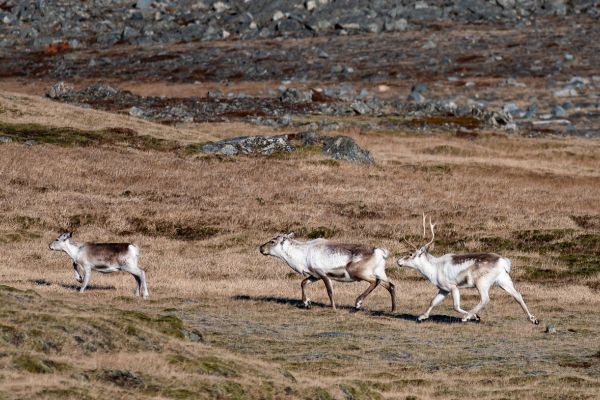
You’re reasonably likely to spot a herd just driving the East Fjords at the right time of year. If you specifically want to see them, head to the Reindeer Park, established in 2021 for rescued animals. The East Iceland Heritage Museum, in Egilsstaðir, pairs naturally with it, a permanent exhibition covering reindeer life and survival in the east, the natural and human threats they face, reindeer research, hunting history, and how reindeer products get used in food and craft, including a 1940s film, Á hreindýraslóðum, and photographs and artifacts from the collection.
- How to get to the East Iceland Heritage Museum: Laufskógar 1, 700 Egilsstaðir.
- Opening Times of the East Iceland Heritage Museum: 1 September – 31 May Tuesday to Friday 11:00 to 16:00; 1 June to 31 August Monday to Friday 10:00 to 17:00, Saturday 11:00 to 17:00
- How long to spend at the East Iceland Heritage Museum: 45-60 minutes.
- Entry Cost: 1,500 ISK for adults; under 17 years free.
- Parking: free nearby.
If you prefer a guided option that combines reindeer spotting with one of this cluster’s other big draws, then this Stuðlagil Canyon & Reindeer Park tour covers both in one day out from Seyðisfjörður. For a bigger picture on Iceland’s wildlife beyond reindeer, see my wildlife guide.
Vestrahorn on the Stokksnes Peninsula
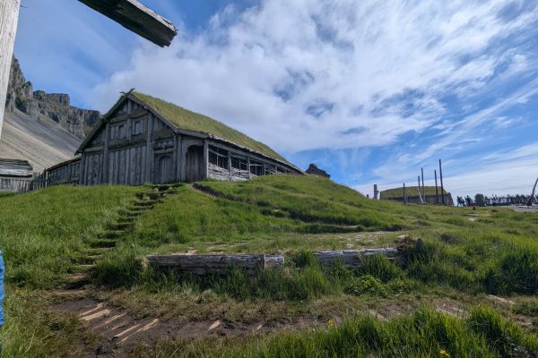
Vestrahorn is one of Iceland’s most photographed mountain ranges, a jagged wall of peaks rising straight out of a black sand beach on the Stokksnes peninsula, with the tide pools in front doubling as a natural mirror on a calm day. The land is privately owned, and there’s a small entry fee per person (as opposed to a parking fee – read my guide to parking in Iceland for all the gen on this.) to access the beach and viewpoints, alongside a recreated Viking village built as a film set that you can also walk through. The beach here is just glorious and my favorite black sand beach in Iceland.
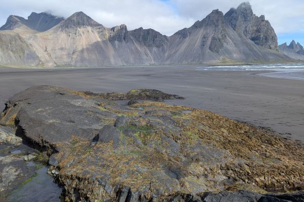
The turn-off to get to the peninsula is just off the Ring Road, but some of the roads out to Stokksnes itself are gravel, in generally excellent condition, though you’ll want to keep some distance behind any vehicle ahead of you because of the dust. The black sand here comes from the same source as most of Iceland’s dark beaches, pulverized basalt, a dark, iron-rich volcanic rock ground down into fine sand over centuries, with dunes topped by grass giving the beach its distinctive look. It’s a seriously windy spot most days, and your sunglasses will earn their keep here for keeping sand and grit out of your eyes as much as for the sun. There are several hiking trails here of varying lengths, although don’t be surprised if the wind cuts your plans shorter than you’d hoped.
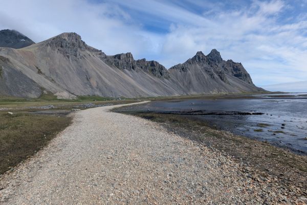
Vestrahorn’s fame extends well beyond photography, too; the mountain has stood in for the lands beyond the Wall in Game of Thrones, and for the “Valley of the Lost Souls” in Netflix’s The Witcher. The Viking Village Film Set nearby was built in 2010 for a film project, Víkingur, directed by Baltasar Kormákur. It ultimately ran into funding trouble and was never made. The set itself was finished regardless, and includes traditional turf houses, a warship, and a dungeon, though you can’t go inside most of the buildings now; some of them have become unsafe.
- How to get to Vestrahorn: signposted off Route 1, a short detour onto the Stokksnes peninsula east of Höfn.
- How long to spend at Vestrahorn: 45-60 minutes.
- Entry: 1,100 ISK per person, paid at the on-site café.
- Parking: free, included with entry.
Skútafoss
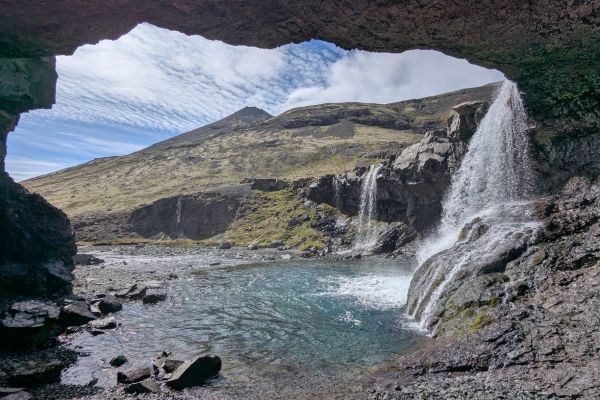
This is a small, easy waterfall visit with a small cave that sits just off Route 1 between Vestrahorn and Eystrahorn. It’s quiet enough that you’ll likely have it to yourself.
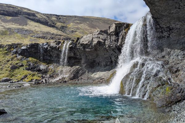
Two separate waterways actually make up this waterfall, both part of the Þorgeirsstaðaá river as it drops through Þorgeirsstaðadalur valley, and an eroded section of rock behind one of them has carved out the small cave the falls are named for.
- How to get to Skútafoss: just off Route 1, roughly 20 minutes east of Höfn.
- How long to spend at Skútafoss: 20-30 minutes, including the short walk in.
- Entry: free.
- Parking: free, small gravel area.
The Red Chair
This quirky little roadside stop is just a bright red chair bolted straight onto a rock, with sweeping views over the mountains and sea behind it. There’s no real history to it that I could find and no plaque explaining why; it’s simply become a spot people stop for a photo, and well, that’s fine.
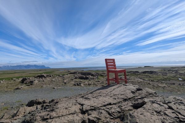
Because it’s so pretty here.
- How to get to the Red Chair: just off Route 1 between Höfn and Egilsstaðir, near the Almannaskarðsgöng tunnel.
- How long to spend at the Red Chair: 10 minutes.
- Entry: free.
- Parking: free, roadside pull-off in gravel parking.
Hálsaskógur Picnic Forest
Hidden just off the road in the Djúpivogur Forestry Association area, Hálsaskógur is the kind of stop that never makes anyone’s must-see list and yet it probably should. We had the whole place to ourselves, tucked away from the road, and it’s really worth knowing there are flush toilets here, with running water too, a real luxury this far out. (Want to know where you’ll find toilets around Iceland? Check out Krapp.is – it’s referenced in my guide to essential Iceland apps). This is a great spot to break up the drive with lunch or a quiet half hour among the trees.
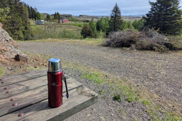
Iceland’s forestry associations planted sites like this one from the mid-20th century onward, part of a wider national push to establish woodland in a country that lost most of its original birch forest to settlement-era clearing centuries ago. Hálsaskógur itself is a planted forest rather than a natural remnant, sheltered enough that it supports considerably taller growth than the open, wind-scoured land around it, which is exactly why it makes such a good picnic stop; real shade and shelter are rare commodities on this stretch of the Ring Road.
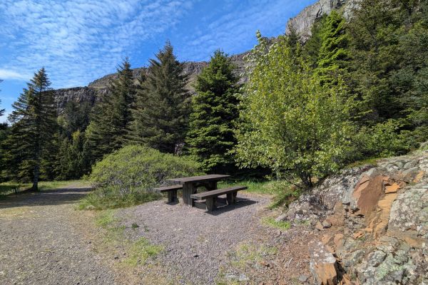
Paths wind gently through the trees, and there are a handful of picnic tables scattered about if you’d rather sit properly than perch on a rock.
- How to get to Hálsaskógur: in the Djúpivogur Forestry Association area, a short detour off Route 1.
- How long to spend at Hálsaskógur: 20-30 minutes, longer if you’re stopping for lunch.
- Entry: free.
- Parking: free.
Eggin í Gleðivík (Djúpivogur)
Along the harbor in the small town of Djúpivogur sit 34 stone eggs, each one modeled on the egg of a different bird species found in the region, an outdoor sculpture installation by artist Sigurður Guðmundsson.
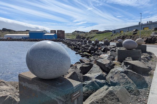
Sigurður Guðmundsson, born in 1942, is one of Iceland’s best-known conceptual artists, a founding member of the influential SÚM collective that shook up Icelandic art in the 1960s, working across sculpture, photography, and performance rather than sticking to one medium. He installed the eggs here in 2009, choosing granite for each one specifically because its natural coloring and texture echo the real egg of the bird it represents, right down to the speckling on some of the smaller ones.
- How to get to Eggin í Gleðivík: along the harbor front in Djúpivogur, just off Route 1.
- How long to spend at Eggin í Gleðivík: 20-30 minutes.
- Entry: free.
- Parking: free on the waterfront, follow signage and only park where it’s indicated that you can
Geirsstaðakirkja Turf Church
The gravel road takes you to Geirsstaðakirkja, is well made, but narrow in places. Narrow enough that we found one rental vehicle that had obviously tried to turn around, and gone off the road (sadly no photo), and had been abandoned. You’ll want to read my guide to renting a car in Iceland for some important information.
However, this rebuilt Viking turf church is worth the detour. Delightfully, you can actually get inside for a look, unlike some of Iceland’s other reconstructed sites. It’s a small reconstructed turf church, built on the site of an actual Viking-age church uncovered during an archaeological dig nearby.
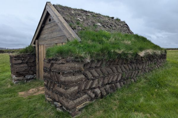
While this is a replica, it’s a faithful one: an excavation here in 1997 revealed the ruins of the original structure, and the reconstruction that followed, built between 1999 and 2001 and blessed in 2001, followed the turf-building style used across Iceland between roughly 930 and 1262. Just five original turf churches survive in Iceland today, mostly up north, and you’ll get to see the oldest of them, Grafarkirkja, in a few days if Skagafjörður and Tröllaskagi in North Iceland are next on your route. It’s tiny, simple, and free to look around, a quick, worthwhile stop rather than a destination in its own right.
- How to get to Geirsstaðakirkja Turf Church: a short detour off the main road near Egilsstaðir.
- How long to spend at Geirsstaðakirkja Turf Church: 15-20 minutes.
- Entry: free.
- Parking: free.
Seyðisfjörður
The drive onto Seyðisfjörður takes you over Route 93, one of the highest paved roads in Iceland, albeit only 600 meters (2,000 feet) at its peak. It’s an important road, too, leading to the only car ferry port in Iceland with international operations; a weekly car ferry connects to both Denmark and the Faroe Islands.
The weather can change quickly up here, and it was foggy, cold, and snowy the day we drove over, so keep your wits about you and check the weather forecast too.
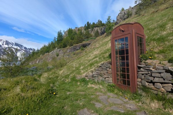
Seyðisfjörður itself is a gorgeously picturesque small town at the end of a fjord, and that’s a nice change of pace; many of the places you’ll pass through on the way here have, by design, been built utilitarian and industrial to cope with Iceland’s weather. Seyðisfjörður is famous as the site where the first international telegraph cable in Iceland came ashore, arriving from Scotland in 1906, marked today by a rusty telephone box installed for the cable’s centenary in 2006.
The cable’s arrival on August 25, 1906, connected Iceland to the outside world by telecommunications for the first time in the country’s history, a real turning point after centuries of relative isolation, and it’s part of why Seyðisfjörður punches so far above its size in national significance. The telephone box sculpture itself, titled How’s It Going?, sits on Hafnargata road on the northeast edge of town, right at the exact spot the cable came ashore, worth the short walk out even if telecom history isn’t usually your thing. You’ll find it here.
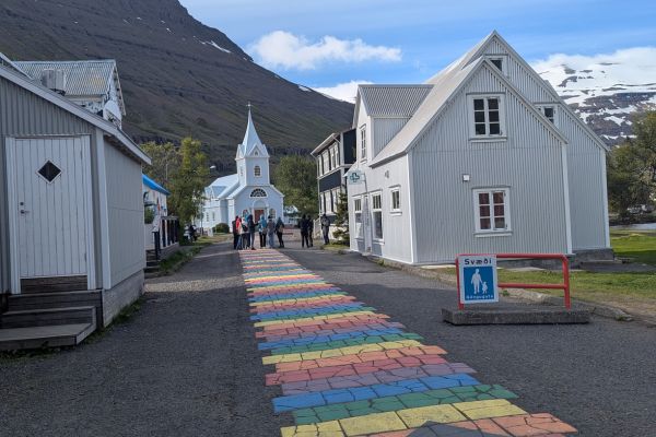
That’s not why most people come to this town of just 700 residents, though. They come because a local named Snorri couldn’t make it to Reykjavik’s Pride celebrations one year, so he convinced his fellow residents to paint a rainbow path leading up to the town’s church instead. It was only ever meant to be temporary, but it’s become permanent and has since inspired similar rainbow installations across Iceland.
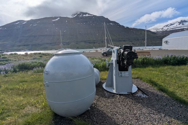
The fjord has its own wartime history too; it was the site of the WWII sinking of the SS El Grillo, a British oil tanker sunk by German planes on February 10, 1944. The ship was heavily damaged and ultimately scuttled, though its forward gun is still on display in town, alongside information boards telling the full story of the sinking.
Iceland remained officially neutral throughout the war, but Britain invaded on 10 May 1940 to keep Nazi Germany from using the island to control the North Atlantic, and American forces took over Iceland’s defense on 7 July 1941. Iceland has never had an army of its own, the only NATO member without one, and manages its national defense through the Icelandic Coast Guard and defense agreements with other countries instead.
If the wartime history of Iceland interests you, the Icelandic Wartime Museum in Reyðarfjörður, about an hour south of Seyðisfjörður, is worth the detour, housed in a former British army camp, with artifacts, uniforms, and displays covering the Allied occupation of East Iceland specifically. There’s a second, similarly worthwhile option on the other side of the country too, the War and Peace Museum in Hvalfjörður, West Iceland, near Akranes, covering the wider story of the 1940-45 occupation, and it’s worth knowing about if your trip takes in both ends of the country.
Seyðisfjörður is East Iceland’s most photographed town for good reason: wooden houses in bright colors, a dramatic fjord setting, and a real sense of having driven somewhere properly remote, since getting here means crossing a mountain pass from Egilsstaðir.
If you want to see more of the fjord than the town itself offers, two guided options are worth knowing about: the Mt. Bjólfur 4×4 tour and scenic walk takes you up the mountain overlooking town for the view most people never get, and this Seyðisfjörður nature and wildlife cruise gets you out on the water itself for a different perspective on the fjord. If horses are a priority on this leg of the trip, then the Husey Horse Farm, also a hostel, is East Iceland’s best-known option and takes direct bookings through their own site.
- How to get to Seyðisfjörður: over the mountain pass from Egilsstaðir on Route 93, about 25-30 minutes.
- How long to spend at Seyðisfjörður: 2-3 hours, longer if you’re staying overnight.
- Entry: free to walk around town.
- Parking: free.
Borgarfjörður Eystri
One of the more remote stops on this whole route, and well worth the extra drive. It’s a small fjord village with a well-known puffin colony at Hafnarhólmi, viewable from a series of boardwalks right by the harbor, with no boat needed.
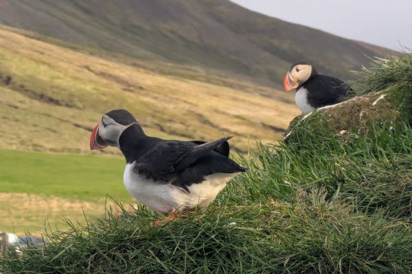
Hafnarhólmi itself is a tiny marina and clifftop location right at the very top of northeast Iceland, home to the puffin colony, and it’s a truly striking spot, the kind that photos do more justice to than words ever could. Around 10,000 pairs nest here each summer, and boardwalks and viewing platforms let you get right up close to the colony without any risk to you or the burrows, one of the easiest and safest puffin-watching spots in the whole country. It’s also, for our money, the best of Iceland’s puffin colonies precisely because of the people who visit it: no noise, no chattering, no loud exclamations, just quiet, respectful watching.
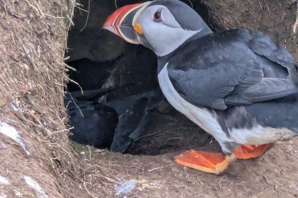
We’ve covered puffins properly in our puffins guide, and it’s well worth a read before you go. There’s also a live puffin webcam if you want to check activity before making the drive out, or just watch from home. The puffins themselves spend their days out at sea and come home in the evening, feeding the young waiting in the burrows for mum and dad to bring dinner back, so time your visit accordingly if you want the best chance of seeing them up close. That usually means a long late drive, or staying overnight. And yes. It’s worth staying the night rather than rushing back; Blábjörg Guesthouse is the obvious option here, with its own spa and an on-site distillery and brewery, more on both under Food & Drink below.
- How to get to Borgarfjörður Eystri: north of Egilsstaðir via Route 94, roughly an hour’s drive.
- How long to spend at Borgarfjörður Eystri: half a day at least, more if you’re hiking.
- Entry: free.
- Parking: 1,000 ISK, pay via Checkit.is.
Vök Baths
Vök Baths is East Iceland’s answer to the Blue Lagoon, modern geothermal pools floating directly on Lake Urriðavatn near Egilsstaðir, Iceland’s only floating geothermal pools. The name means “ice-free,” an old word for the patch of open water that never quite freezes on the lake even in the depth of winter, which is exactly what first drew attention to the site.
A main pool sits alongside two smaller floating pools out on the water itself; temperatures across the baths range from about 38-41°C (100-106°F), with a roughly 50°C (122°F) sauna and a cold mist tunnel at the other end of the scale if you want the full contrast. We’ve covered this more extensively in our hot springs and lagoons guide.
- How to get to Vök Baths: on Lake Urriðavatn, a short drive from Egilsstaðir.
- How long to spend at Vök Baths: 1.5-2 hours.
- Entry: from $61 per person. Prebook your tickets here.
- Parking: free on site.
Hengifoss
Hengifoss is Iceland’s third-tallest waterfall, and one of its most distinctive; striped bands of red clay and dark basalt run through the canyon walls around it. It is truly unusual even by Icelandic waterfall standards. At 128 meters (420 feet), Hengifoss drops from a height that puts it just behind Morsárfoss and Glymur among the country’s tallest falls and is fed by the Hengifossá river as it winds down from the highlands above.
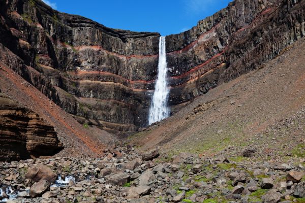
Getting there takes a proper 2-3 hour round trip hike, not a five-minute stroll from a car park, and on the way up you’ll pass Litlanesfoss, a smaller but more striking waterfall framed by some of the tallest, most symmetrical basalt columns in the country, and this is worth the stop in its own right rather than just a photo op on the way to the main event.
- How to get to Hengifoss: signposted off Route 931 in Fljótsdalur, south of Egilsstaðir.
- How long to spend at Hengifoss: 2-3 hours round trip; the hike is roughly 2.5 kilometers (1.5 miles) each way.
- Entry: free.
- Parking: 1,000 ISK, pay via Checkit.is.
Stuðlagil Canyon
Stuðlagil Canyon is a dramatic basalt column canyon with a startlingly turquoise river running through it, largely hidden from view until a nearby dam reduced the water flow and exposed the full scale of the columns a few years back. There are two ways to see it: a shorter walk to a viewpoint on one side, or a longer route to get down closer to the water on the other. It’s worth deciding which one you want before you set off. The easiest is the “main parking area”.
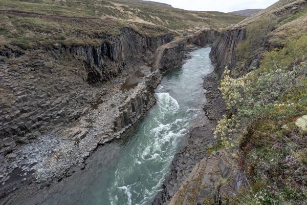
The canyon walls themselves are ancient, but the canyon as a sight to see is remarkably recent; it wasn’t actually discovered until 2009. A hydroelectric project lowered the water level of the Jökulsá á Dal river that year, and the basalt columns that had sat hidden beneath higher water for centuries were suddenly exposed. It’s a good reminder of how central hydropower is to this country; more than 73% of Iceland’s electricity comes from hydroelectric sources, with the remainder from geothermal, meaning the national grid runs on 100% renewable power.
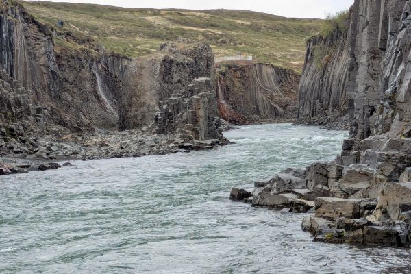
Stuðlagil Canyon sits in the Jökuldalur valley, and you can access it from either side; the east side requires a 2.5 kilometer (1.5 mile) hike from the parking area, while the west side has extensive viewing platforms and a much easier approach. If you want to see the canyon from both sides, then it’s a long but scenic detour to get from one side to the other by road. We visited from the main, west side, and you can get down to the river on both sides these days.
- How to get to Stuðlagil Canyon: inland from Egilsstaðir, following signs for Jökuldalur.
- How long to spend at Stuðlagil Canyon: 1-2 hours, depending on which side you visit.
- Entry: free.
- Parking: 1,000 ISK, pay via Parka, at the trailheads on both sides.
If you prefer to combine visiting the canyon with reindeer spotting on a guided day out, then this Stuðlagil Canyon & Reindeer Park tour covers both from Seyðisfjörður in a single day.
Map of Attractions in East Iceland
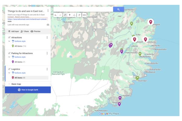
Here’s our map of all eleven stops in this guide; you can also see the map here.
Visiting East Iceland
Unlike the South Coast or Snaefellsnes, East Iceland is not a day trip from Reykjavik; it’s simply too far. Here’s how people actually get here instead.
As Part of the Ring Road
The most common way to see this region, simply as the stretch of Route 1 between the South Coast and North Iceland. Give it more time than the map suggests you need; this is the part of the Ring Road most people regret rushing.
Flying into Egilsstaðir
Egilsstaðir has its own domestic airport, with short flights from Reykjavik, a real option if you want to base yourself in East Iceland specifically without driving the whole Ring Road to get here.
The Seyðisfjörður Ferry
This is truly unique to East Iceland; Seyðisfjörður is Iceland’s only international ferry port, with a weekly Smyril Line service connecting to the Faroe Islands and Denmark. If you’re bringing your own car or campervan into Iceland rather than renting one, this is how you get here.
Prices vary a lot by season, cabin type, and whether you’re bringing a vehicle, so check Smyril Line’s official booking page directly for current fares rather than relying on a number here that may already be out of date.
How to Get to East Iceland
By road, East Iceland is roughly 650 kilometers (400 miles) from Reykjavik via the South Coast route, a long drive best broken up over several days rather than attempted in one push. See the three options above for the alternatives if driving the whole way doesn’t suit your trip.
Where to Stay to Explore East Iceland
Choices are limited compared to the South Coast or Reykjavik, so book ahead rather than assuming.
- Við Lónið (Seyðisfjörður): this is a great base right in the fjord town itself.
- Guesthouse Egilsstaðir central, practical, close to Hengifoss and Stuðlagil Canyon.
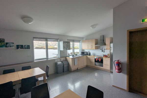
- Blábjörg Guesthouse (Borgarfjörður Eystri) — the standout of the three, worth the extra drive out to the remote north coast for it, its own spa and an on-site distillery and brewery, despite this not being a geothermal area. Book early for private bathrooms, however, the shared bathrooms here (3 between 11 rooms) are fabulous. And the shared kitchen, dining area and lounge are comfortable and well equipped too.
How Long to Visit East Iceland
Two to three days lets you cover this area properly without rushing, including the detour out to Borgarfjörður Eystri, which really deserves its own half-day rather than a quick drive there and back.
Grocery Shopping in East Iceland
Egilsstaðir is the region’s main hub and the best place to stock up; with both Bónus and Netto on hand, options elsewhere in East Iceland are fewer. Read more about saving money in Iceland in my guide here.
Food & Drink Options in East Iceland
Options are limited compared to Reykjavik or the South Coast, but what’s here is actually worth planning around.
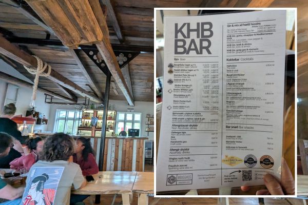
KHB Brugghús Brewery & Distillery, in Borgarfjörður Eystri, is a proper find; their beer Stúlka won gold at the 2025 World Beer Awards and was named Best Sour and Wild Beer in the World in the Berliner Weisse category. It’s rather good, and worth the detour out here even if beer isn’t usually your thing; a pint costs around 1,500 ISK. Check out my guide to alcohol in Iceland here.
Frystiklefinn, Blábjörg’s on-site restaurant in Borgarfjörður Eystri, is worth planning a meal around: homemade dishes using local ingredients, both classic international and traditional Icelandic.
Kaffi Lára, also known as El Grillo Bar, in Seyðisfjörður, is a fabulous option, right in the heart of the fjord town.
FAQs on East Iceland
Got questions about visiting East Iceland? Here are quick answers to what we’re asked most.
Is East Iceland worth the detour?
Yes, and it’s less of a detour than people assume; it’s the natural route between the South Coast and North Iceland on the Ring Road, not a big diversion off it. The real question isn’t whether to include it; it’s whether you’ve given it enough time.
How remote is East Iceland?
This is actually remote by Icelandic standards, and this is the least visited major region in the country, because even the Westfjords get a regular cruise ship stop. There are smaller towns, fewer services, longer gaps between fuel stations.
What’s the most underrated stop in East Iceland?
Skútafoss, without much competition. Most Ring Road drivers have never heard of it, let alone stopped, and it’s one of the easiest, quietest waterfalls on this entire list.
Can you do East Iceland without a 4×4?
Yes, the main routes covered in this guide, including the road out to Borgarfjörður Eystri, are accessible in a standard car. A 4×4 becomes more relevant if you’re venturing onto the highland F-roads.
Is there a ferry connection to East Iceland?
Yes, Seyðisfjörður is Iceland’s only international ferry port, with a weekly Smyril Line service to the Faroe Islands and Denmark, useful if you want to bring your own car into the country.
ICELAND TRAVEL RESOURCES
AIRPORT TRANSFERS
24/7 pickup & drop off. Trusted, local English speaking drivers. Prebook & prepay online with cards.
Book a Transfer
HOTELS AND APARTMENTS
See choices here
Rooms with a view? Budget rooms? Need a washing machine? The best choice of hotels & apartments.
TOURS & ATTRACTIONS
Most excursion choices, small group tours, skip-line tickets, free cancellation and top local guides.
Top options here.
CAR RENTAL OPTIONS
Choose cars here
Best choice of vehicles, automatics, large or small cars, child seats. Book early for more options.
Final Words on East Iceland
East Iceland doesn’t chase attention the way the South Coast or Golden Circle do, and that’s precisely why it rewards the travelers who slow down here rather than rushing through. Fewer crowds, quieter roads, and a handful of stops: Skútafoss, the eggs at Djúpivogur, Stuðlagil’s turquoise water, that most people driving the Ring Road never even know they missed.
ASocialNomad is a participant in the Amazon Services LLC Associates Program, an affiliate advertising program designed to provide a means for sites to earn advertising fees by advertising and linking to amazon.com, amazon.co.uk, and amazon.ca. Amazon and the Amazon logo are trademarks of Amazon.com, Inc. or its affiliates. As an Amazon Associate, I earn from qualifying purchases.

